EXPLORING SAN DIEGO COUNTY AND BEYOND BY LENS
  • Exploring San Diego
  • Day Trips
    • Campo >
      • The Campo Stone Store
      • Campo Pioneer Burial Plots
      • Mystery Rock
      • Rail Road Trestle HWY 94
      • Southern Terminus PCT
      • WWII Pow Chapel
      • Incinerator Camp Lockett
    • Cuyamaca Forest >
      • The Airplane Monument
    • Old Hwy 80 >
      • Boulevard >
        • Masonic Hall Ruins
    • Carlsbad >
      • Mount Calavera
    • Descanso >
      • Ellis Wayside Rest
    • Downtown San Diego >
      • The Old San Diego Jail Cells
    • Escondido >
      • Lake Hodges Dam
    • Jacumba >
      • Mica Gem Mine
      • Carrizo Creek Area
      • Goat Canyon Trestle
      • Happy's Place
      • Jacume
      • Round Mountain
      • Table Mountain
      • Union 76 Sign
      • Valley of The Moon and Vicinity >
        • Border Marker 231
        • Cabin Ruins
        • The Carpet Cave
        • Elliott Mine
        • Smugglers Cave
        • The Antenna Ruins
    • Jamul >
      • Jamul Cement Works
      • Mt. McGinty
    • La Jolla >
      • Kayaking La Jolla
      • Photos La Jolla
      • Sunny Jim Cave
    • Julian >
      • The Warlock Mine
    • Mission Trails Regional Park >
      • Flooding Mission Trails
      • Tree Frogs Season
    • Mountain Springs >
      • Devils Canyon
      • Happy's Camps
      • The Sheep Pens
    • Mount Laguna Area >
      • Pine Valley >
        • Secret Canyon Trail
      • Laguna Meadows >
        • The Pioneer Cemetery
      • Garnet Peak
      • The Pioneer Mail Trail
      • The Pump House
    • Point Loma >
      • Battery E Control Station
      • Bennington Memorial
      • Sea Caves Point Loma
    • Solana Beach >
      • Annies Canyon Trail
  • Forgotten Places
    • Ruin Rancho San Diego
    • Abandone Builldings Lake Morena
    • Abandoned Homestead Site
    • Abandone Home Stead 2
    • The Hidden Cave
    • Bankhead Springs Ghost Town
    • The Forgotten Tunnels
    • Buckman's Springs
    • Old Mines Various
    • Pirates Tower
    • Ghost Signs
    • Manhattan AZ Set
    • School Mine
  • Local WaterFalls
    • Mildred Falls
    • Kitchen Creek Falls
    • Orinoco Creek Falls
    • Three Sisters
    • Storm Canyon Waterfall
    • The Devils Jumpoff
    • Cold Stream Falls
    • Cedar Creek
    • Miadenhair Falls
    • Lake Hodges Falls
    • Waterfalls of Oak Canyon
    • Waterfalls of Cottonwood Creek
    • Green Valley Falls
    • Waterfalls of Chariot Canyon
    • Pinto Canyon Falls
  • Rock Art
    • Anza Borrego 2 Rock Art
    • Cave with No Name
    • Initiation Cave
    • The Lizard Man Cave
    • Petroglyph Site
    • Pictographs November 2012
    • Strange Petroglyphs in Imperial County
    • Rock Art Northern San Diego 1
    • Rock Art Site 2
    • Rock Art Site 3
    • Rock Art Various
    • Unknown Rock Art San Diego County
    • Vallecitos Rock Art
    • Milling Sites >
      • Cuayamaca Ovals
  • Beyond
    • Arizona >
      • Yuma >
        • Bridge to Nowhere
        • Castle Dome Ghost Town
        • Yuma Territorial Prison
    • Imperial County >
      • Anza Borrego >
        • Andrade Canyon
        • Carrizo Mountain
        • The Domelands
        • The Slot
        • Morteros Palms to Goat Canyon
        • Sunrise Butte
        • Yuha Basin
        • Mud Caves
        • Rock House Valley
        • Upper Myers Valley
      • Salton Sea >
        • Mud Volanoes
        • The Old Health Spa
        • Salvation Mountain
    • San Gabriel Mountains >
      • The Bridge to Nowhere
  • The Spooky Side
    • Dead Man's Point
    • Mount Pisquah
    • Pioneer Park
    • Witches Tower
    • Haunted Locations >
      • Hangar One Miramar
      • Julian Hotel
      • Queen Mary >
        • First Class Swimming Pool
        • Water Tight Door 13
      • Vallecitos Stage Station
    • Graves >
      • Grave of Kate Morgan
      • Graves Under San Diego Ave
      • Lady in White Grave
      • The Lonely Grave of Amos Buckman
      • The Forgotten Grave of John Helm
      • Whaley Grave
      • Yankee Jim
  • Hollywood F
  • New Page

Strange Petroglyphs in Imperial County 12-9-2018
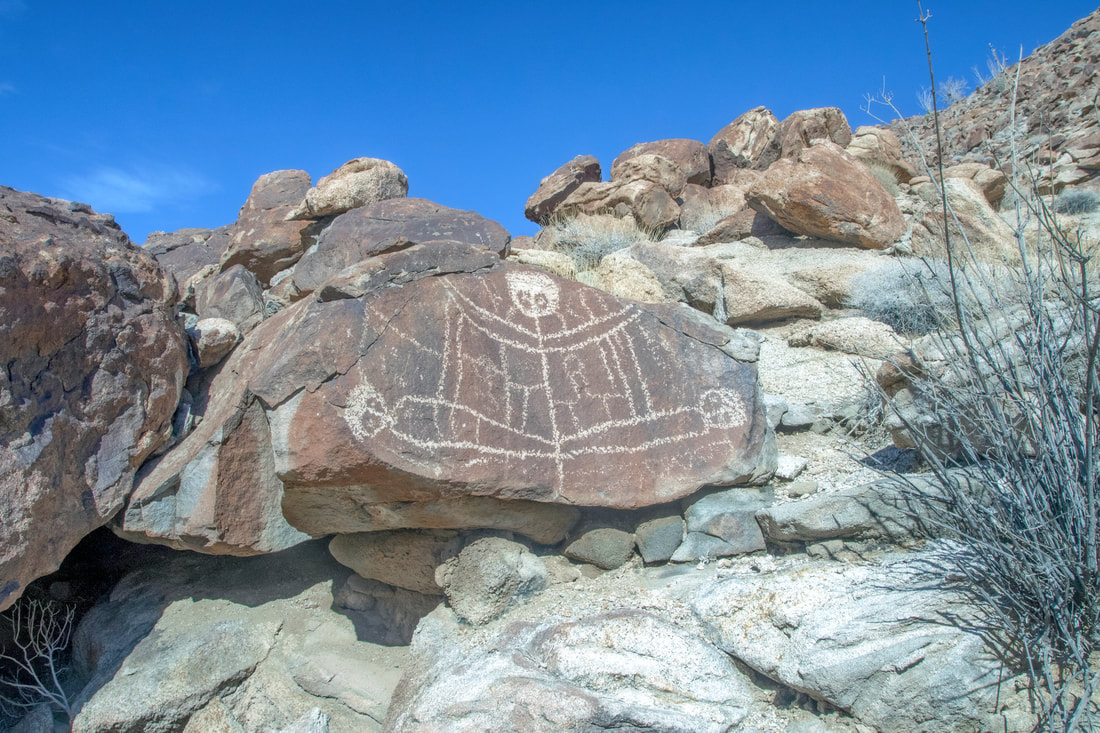
Picture
The Ship Petroglyph Many Stories about this a Treasure lost in the nearby Desert, First contact with Early Explorers or something totally different.
A recent hike into a remote part of the Desert of Imperial
County involving a lot of rock climbing, boulder hopping and bushwhacking.
​We encountered many unusual sites along the way including some unusual rock art in the form of  petroglyphs. there was also Palm Oasis's and signs of early inhabitants and a beautiful countrysides everywhere one looked, everything one wants in a great hike. 
Some of the rock art is very hard to find and takes a sharp eye to spot it, other petroglyphs are fading slowly away and may soon be gone.

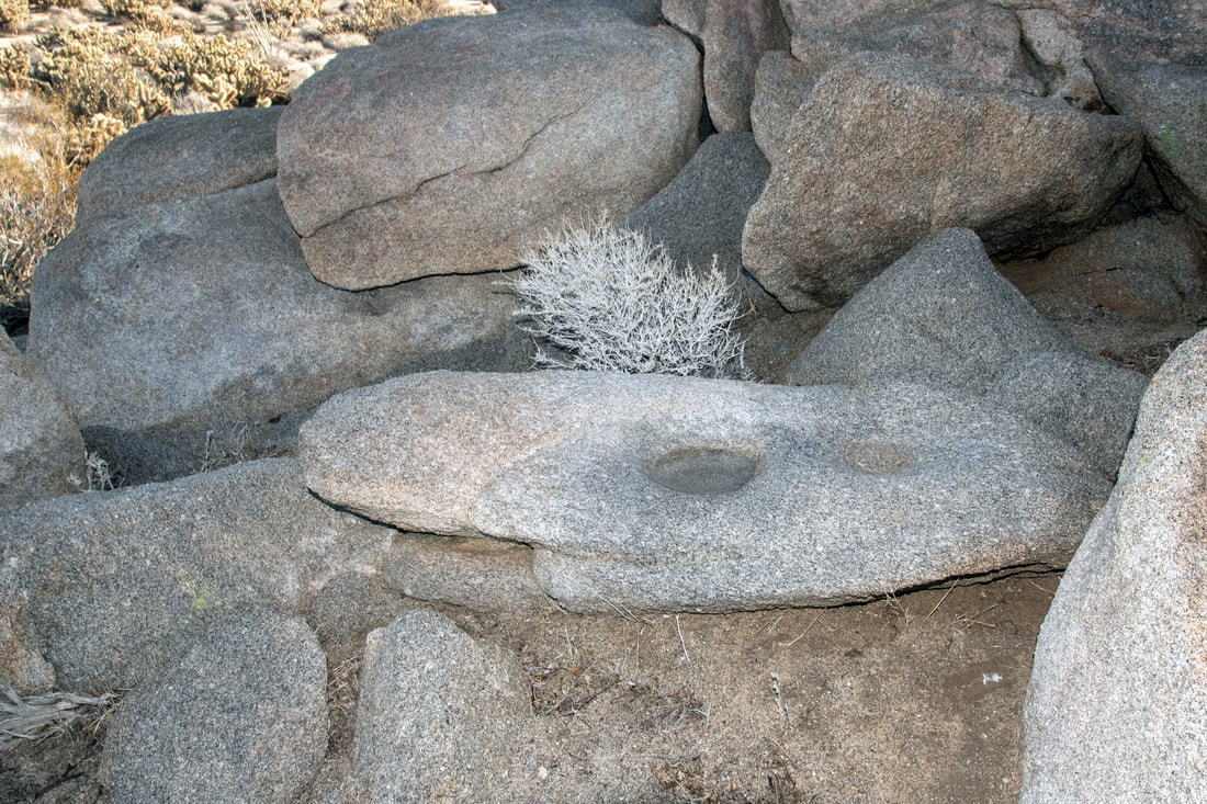
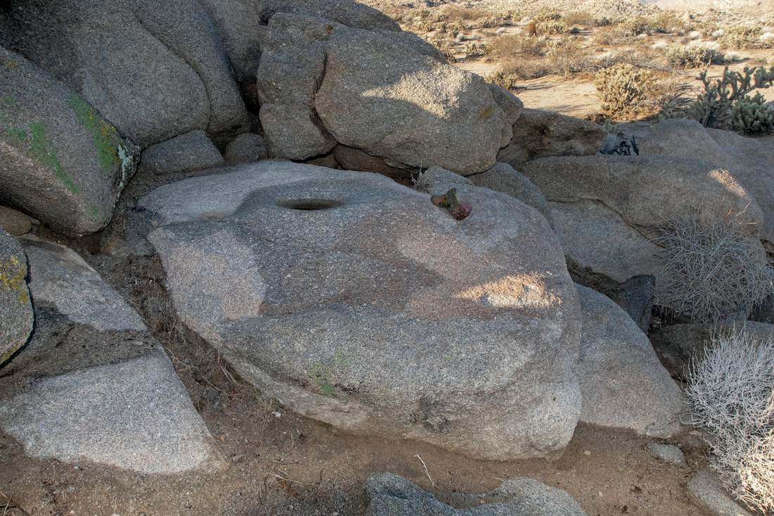
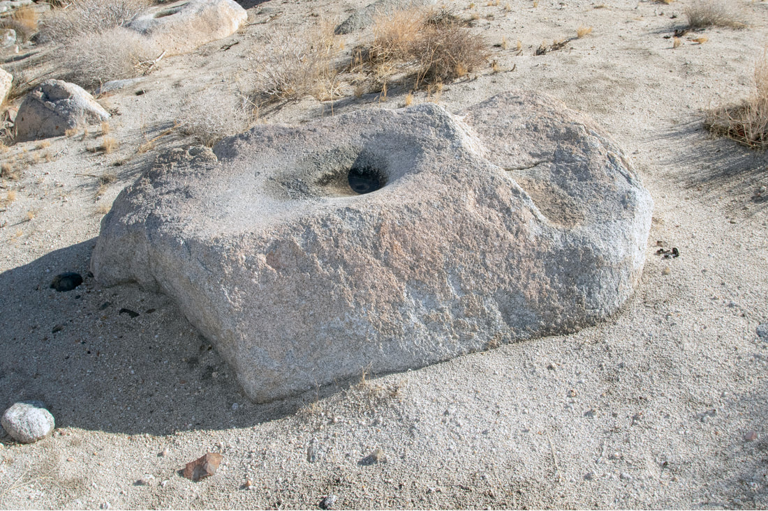
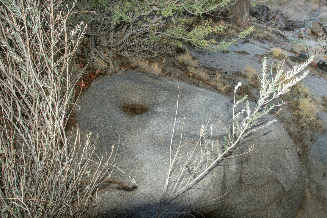
Native American Grinding Site on The Way to The Area

The next four images are of  Mortero's a form of mortars found in rocks. This group was situated within a pile of rocks on the long hike just to get to the area where we wanted to hike into. The mortero is a grinding feature for processing food with the use of a pestle stone.The food is place within the mortero and the pestle stone is hammered up and down to grind the food.This could be nut, seeds,roots or other tough foodstuff. 
Picture
Picture
Picture
Picture

Pestle Stone (not from this hike)

Picture
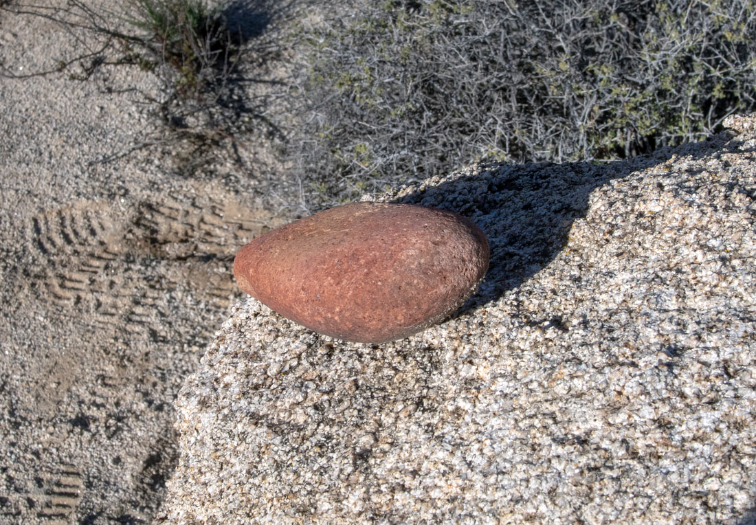
The Pestle stone was used in Mortero's to grind food notice that the one end has been roughened up by the hammering of the stone into the mortero. This was seen on a later hike, but is used for an example.

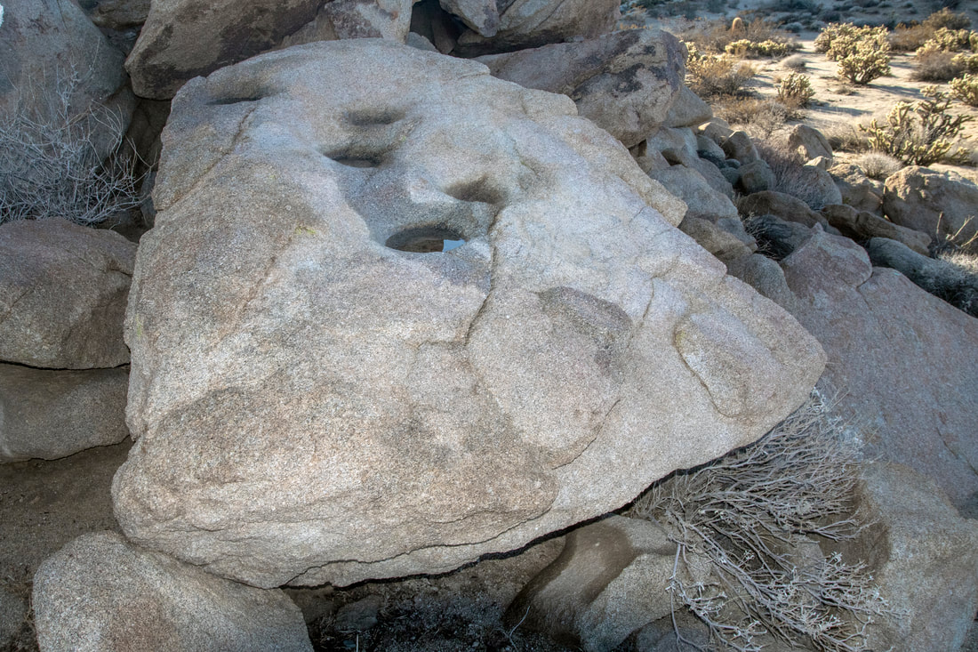
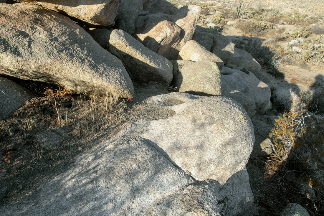
Another Mortero Site

Picture
Needless to say there was a lot of Mortero's. This area which seems sparse and barren to us does support a varied amount of plant life. The amount of Grinding Feature seen, points to the people who were here took advantage of this.

A Good Omen

Picture
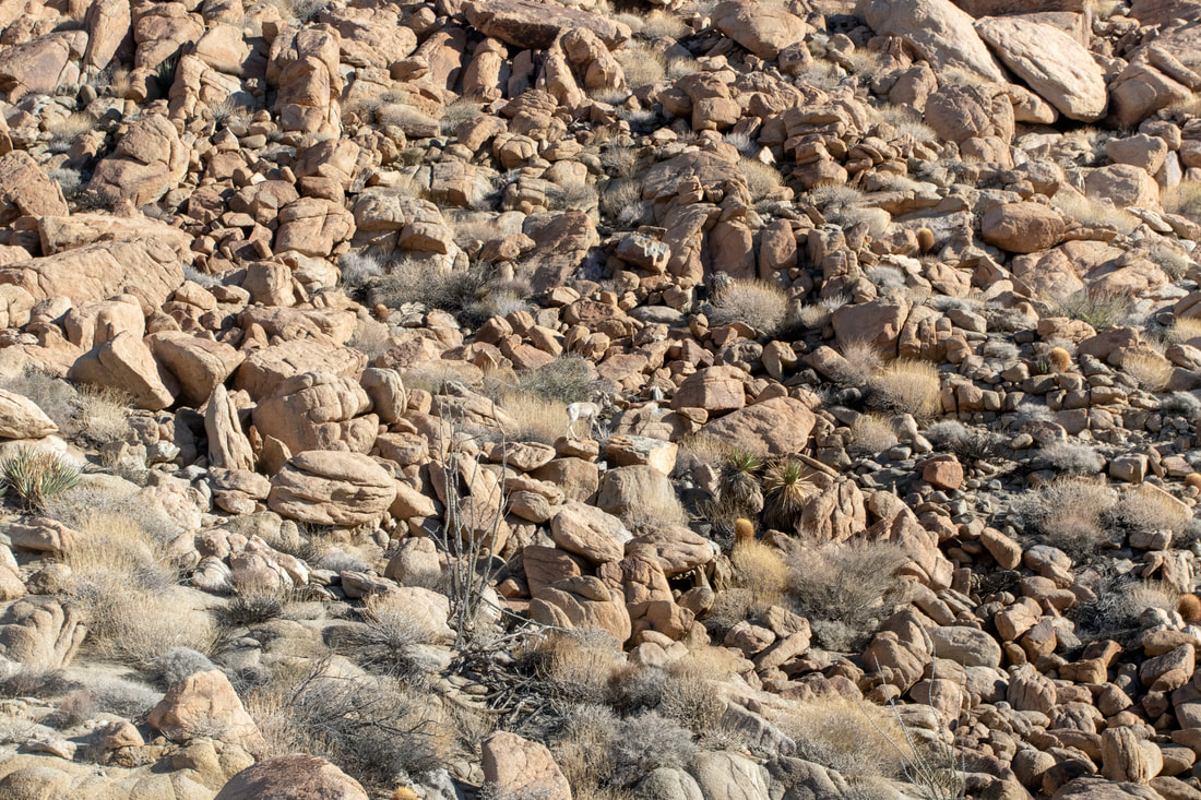
Some Times Wildlife can be right in front of you,but in nature it pays to be inconspicuous. This young Big Horn knows how to blend in.
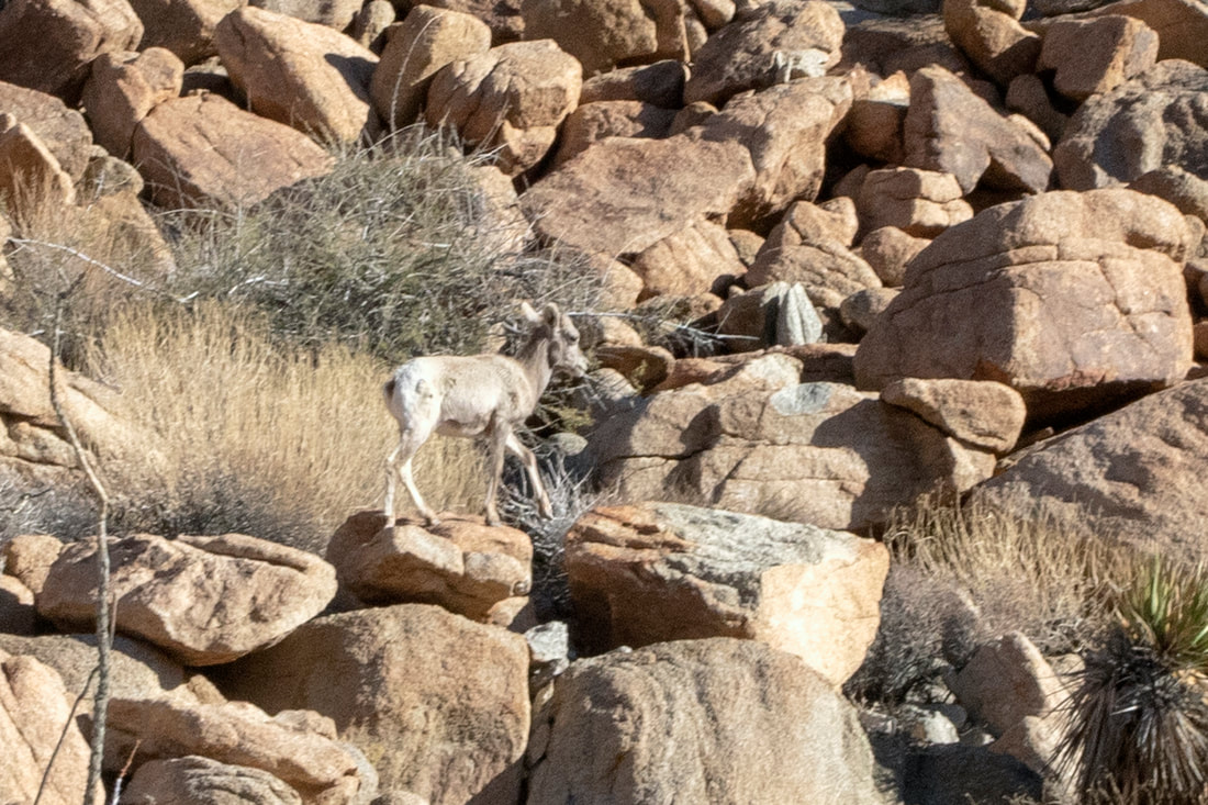
Picture
Here it is The Big horn was actually a lot closer when first seen. I was actually checking out some rocks when it bolted out. Needless to say we all headed for our cameras but the Big Horn is not only surefooted but swift.

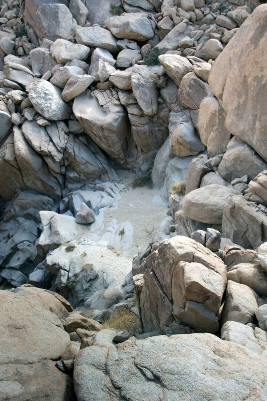
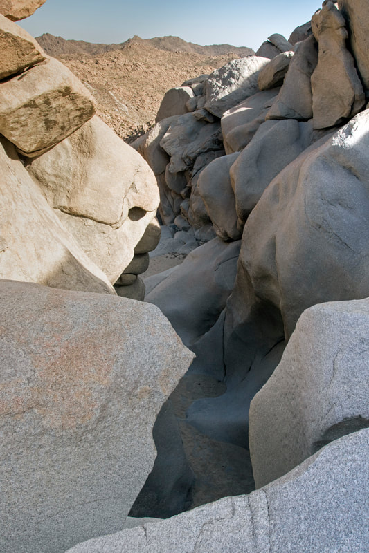
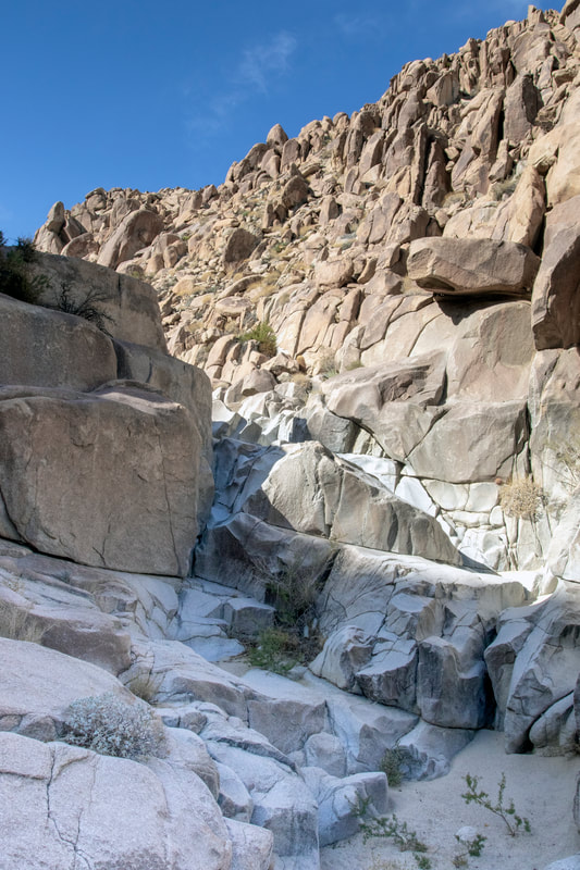
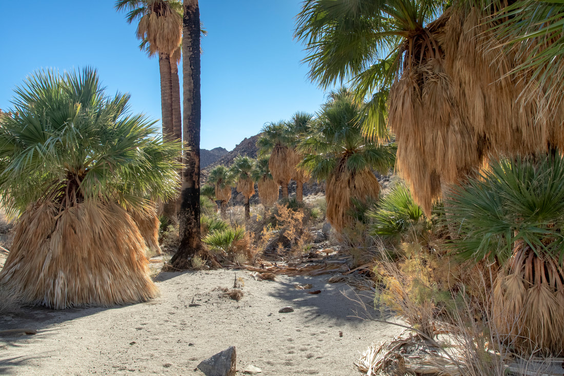
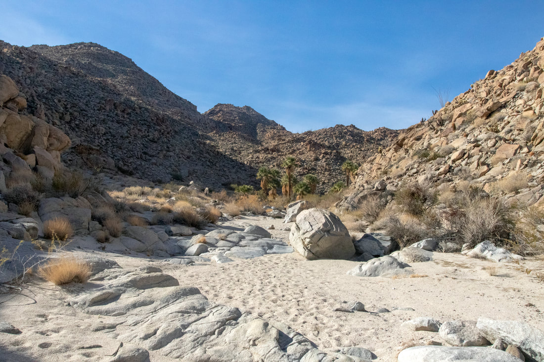
Entering The Canyons

The Hike to this point the opening to the canyon was an arduous hike to get here, then to enter you hit this which goes on for a good ways. Then a long hike ahead of you. When you finish you get to turn around and come back.
There are also branches within so don't mistake these on the way back. The area is remote and not where you want to get into trouble. I did exploratory hikes into both ends and the surrounding area before I decided to do it with friends.
The Area is known to be frequented by Human traffickers and Smugglers.
Picture
Picture
Picture
Picture
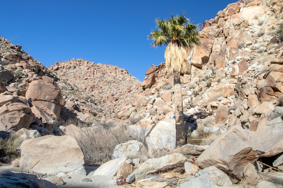
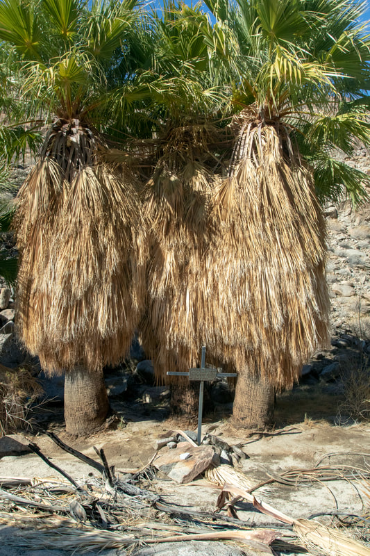
A Palm Tree within the Canyon, There are some very rough sections to get into the Canyon areas from the end we came in.
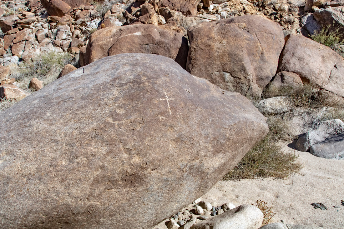
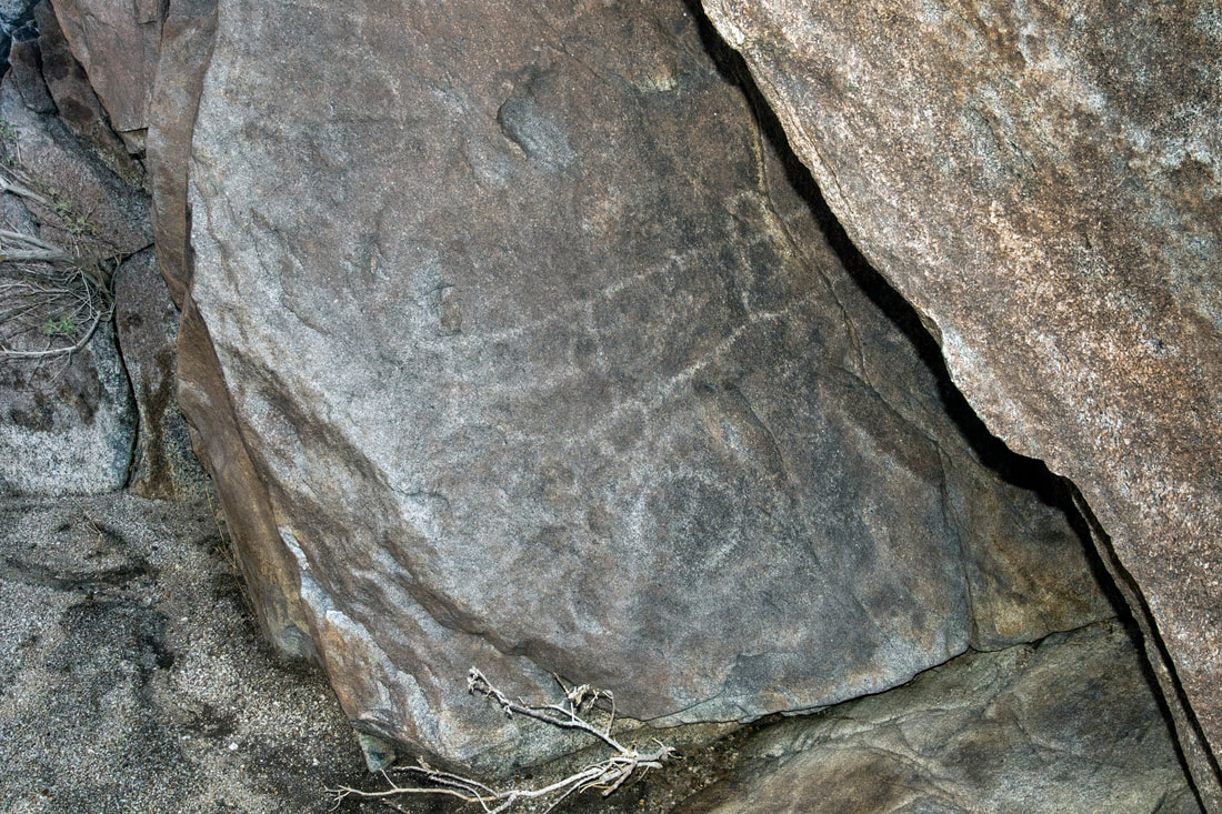
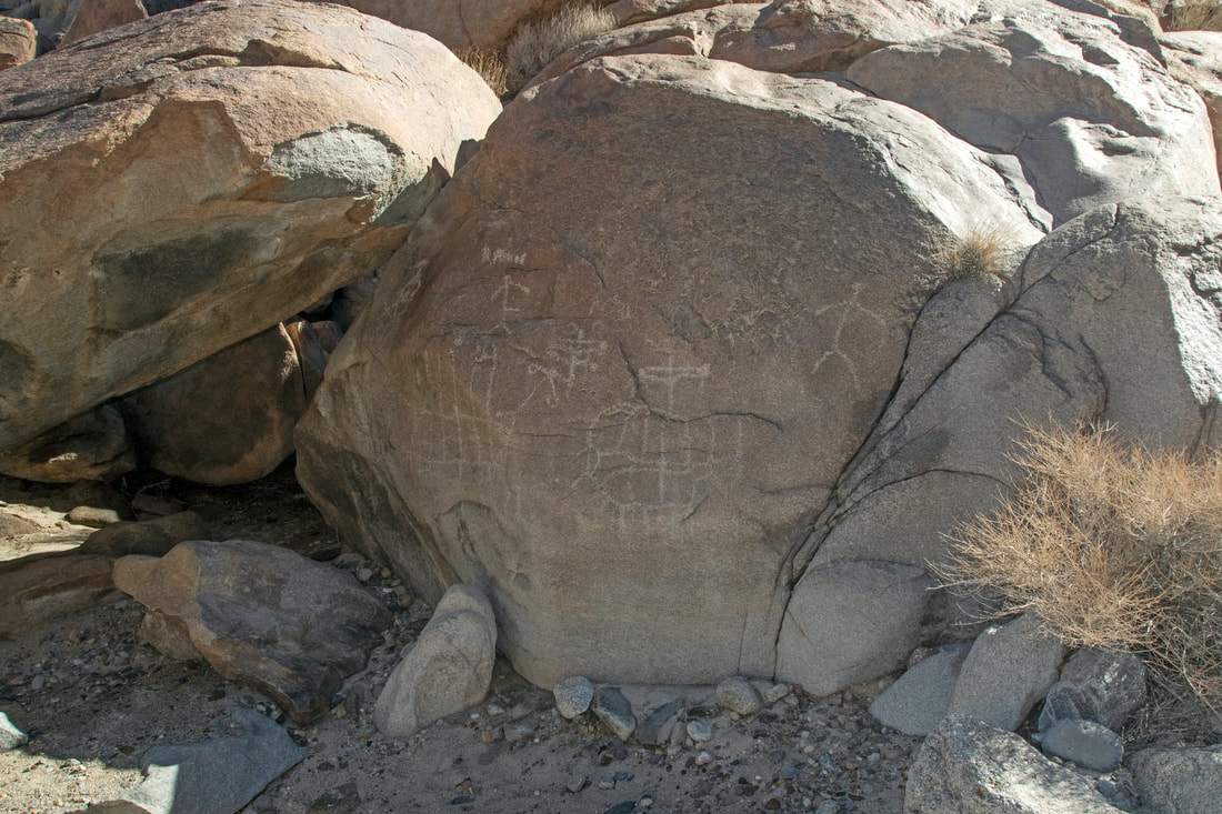
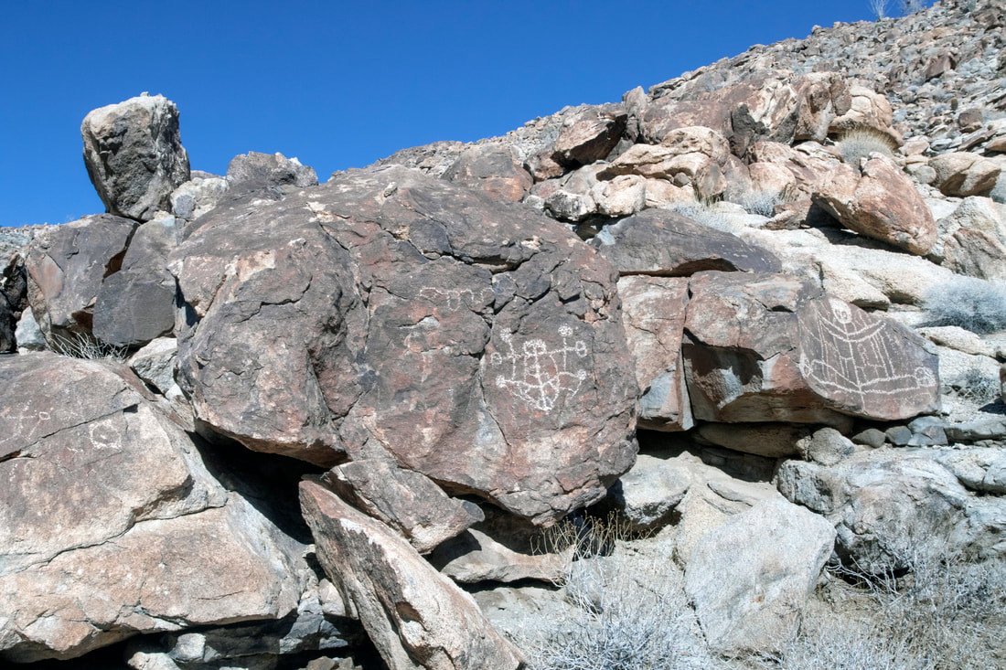
The Petroglyphs are both a bit strange and unusual they are spread out for miles and some are very hard to find.

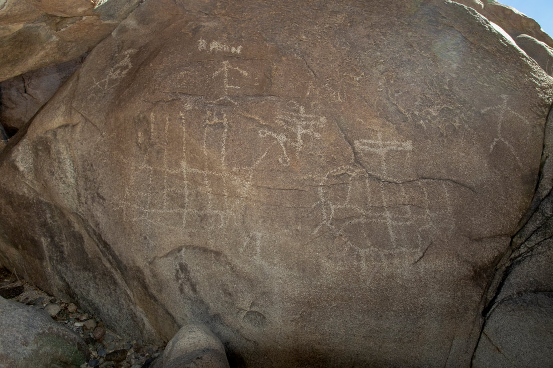
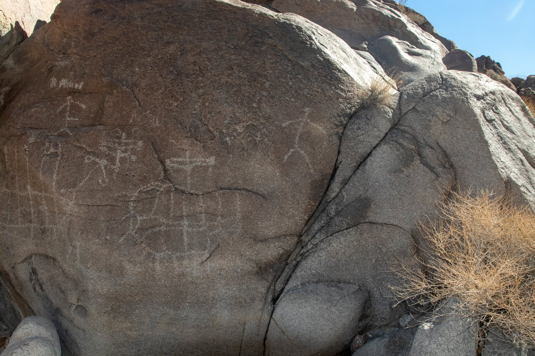
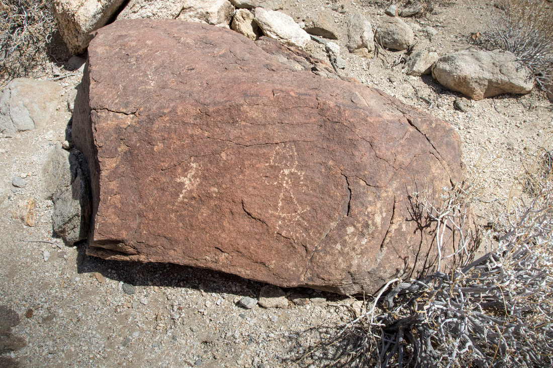
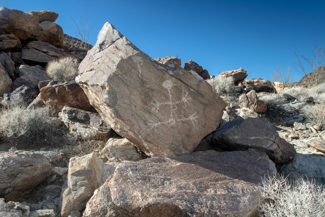
Fading Panels Anthropomophics  and More Enigmatic Symbols
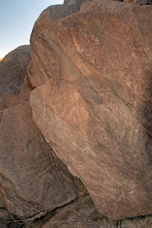
Picture
Panel 1 Symbols on a set of fading panels Anthropomorphic's which means having human characteristics and some more enigmatic symbols.
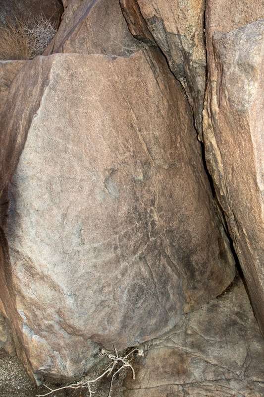
Picture
Panel 2
Picture
Panel2 enhanced
Picture

There is quite a bit of evidence of  previous Inhabitants to be seen

Picture
Picture
Picture
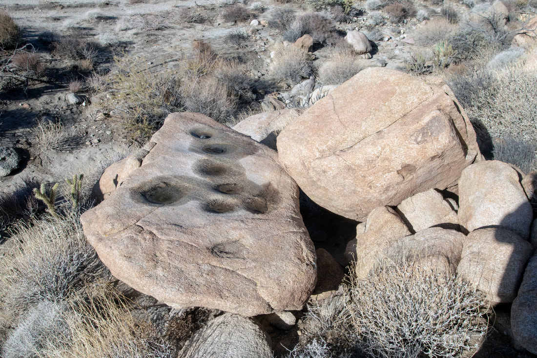
The canyons are loaded with grinding features, if I would post them all there would be pages.

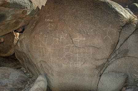
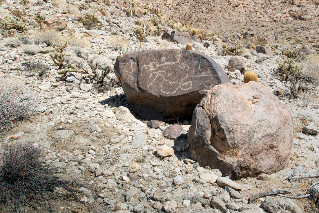
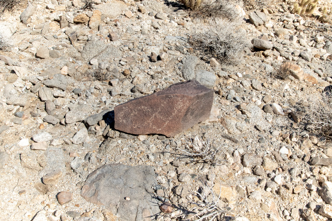
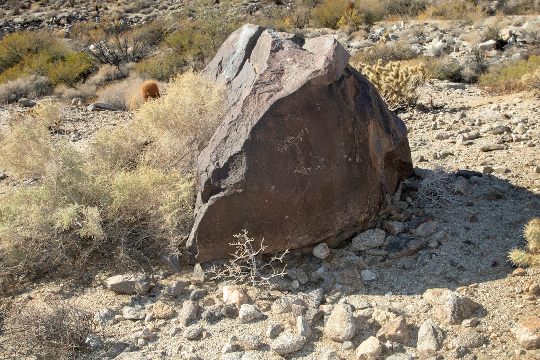
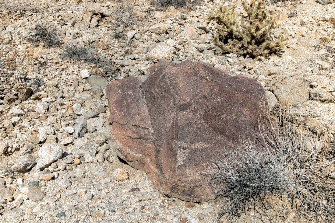
The Ship Petroglyph  Rock Shelter

So This Site is a controversial, The trouble maker is the one that looks like a ship with a furled sail on it,though when you get down to it there are two that look like ships.There are multiple stories for this and the supporters of them can get passionate in their support. One Story with different variations is about Lake Cahuilla of which the Salton Sea is now filling a small area of what use to be the far larger lake. The lake was supposed to be in the story connected to the sea by an inlet and a Spanish Ship laden with treasure and pearls sailed up this connection. The ship was there a short time when a mighty earthquake jarred the land, the water receded when the land lifted up and stranded the ship many miles from the sea.
There a variation with Vikings and Gold, many people have claimed to have found the ships in isolated areas
There also the story that the artist may have observed one of the early explorers sailing along the coast, possibly Rodriquez Cortez himself in 1542. Then again there could be another meaning lost  with the passing of time.
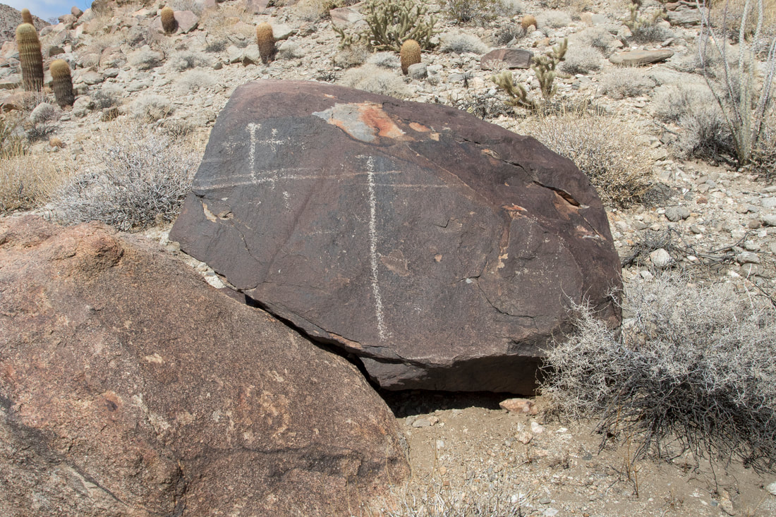
Picture
Picture
Picture
Picture

The Shrine

Picture
A Group of Petroglyphs
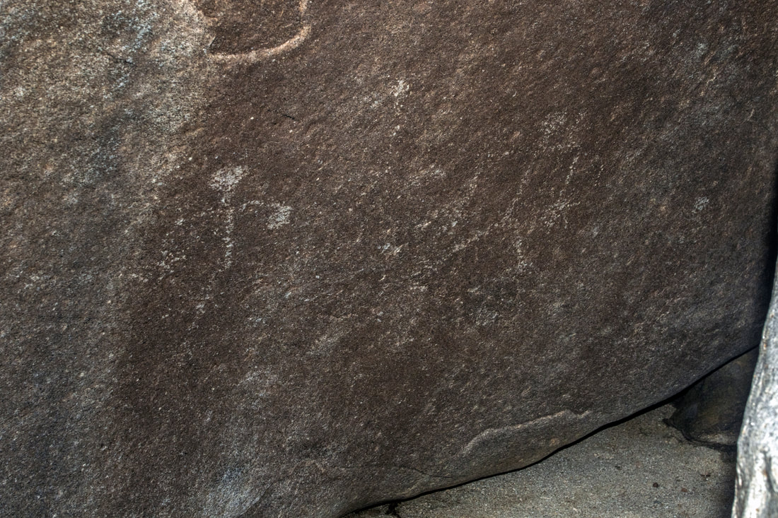
Some rocks over time due to Weathering and or chemical reactions develope a coating sometimes called a desert varnish. Petroglyphs are symbols etched through the darker coating to reveal the lighter rock below.
Pictographs are symbols applied to a surface with a pigment, all rock art spotted on this hike is petroglyhs
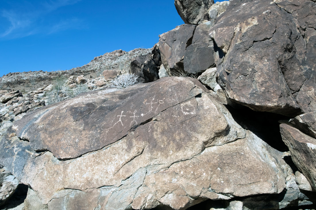
Picture
Picture
Picture
Picture

Lone Anthropomorhic

Picture
Picture
Picture
Picture
Picture
Picture

A last Discovery on The way Back

Picture

A Few other Findings

Picture
Picture
I apologize for not give out directions to most of my trips, trails change and I do not have the time to keep the site always updated. My hikes also span from the easy to the extreme, a lot of places do not even have trails, as well as extreme conditions. Some sites need to be protected as they are fragile and historically sensitive. So if you decide to hike some of these areas, do your research and know your limits, have the proper provisions .Every year many hikers die  from not understanding these Simple Rules. San Diego County and surrounding areas are diverse in climate and terrain. Remember if you do decide to Hike do your research, carry the essentials and do so at your own risk.  An alternative is to join one of the many hiking groups such as meetup or on facebook ,as well as other social sites. Not only is there safety in numbers but a pooling of knowledge. 
  • Exploring San Diego
  • Day Trips
    • Campo >
      • The Campo Stone Store
      • Campo Pioneer Burial Plots
      • Mystery Rock
      • Rail Road Trestle HWY 94
      • Southern Terminus PCT
      • WWII Pow Chapel
      • Incinerator Camp Lockett
    • Cuyamaca Forest >
      • The Airplane Monument
    • Old Hwy 80 >
      • Boulevard >
        • Masonic Hall Ruins
    • Carlsbad >
      • Mount Calavera
    • Descanso >
      • Ellis Wayside Rest
    • Downtown San Diego >
      • The Old San Diego Jail Cells
    • Escondido >
      • Lake Hodges Dam
    • Jacumba >
      • Mica Gem Mine
      • Carrizo Creek Area
      • Goat Canyon Trestle
      • Happy's Place
      • Jacume
      • Round Mountain
      • Table Mountain
      • Union 76 Sign
      • Valley of The Moon and Vicinity >
        • Border Marker 231
        • Cabin Ruins
        • The Carpet Cave
        • Elliott Mine
        • Smugglers Cave
        • The Antenna Ruins
    • Jamul >
      • Jamul Cement Works
      • Mt. McGinty
    • La Jolla >
      • Kayaking La Jolla
      • Photos La Jolla
      • Sunny Jim Cave
    • Julian >
      • The Warlock Mine
    • Mission Trails Regional Park >
      • Flooding Mission Trails
      • Tree Frogs Season
    • Mountain Springs >
      • Devils Canyon
      • Happy's Camps
      • The Sheep Pens
    • Mount Laguna Area >
      • Pine Valley >
        • Secret Canyon Trail
      • Laguna Meadows >
        • The Pioneer Cemetery
      • Garnet Peak
      • The Pioneer Mail Trail
      • The Pump House
    • Point Loma >
      • Battery E Control Station
      • Bennington Memorial
      • Sea Caves Point Loma
    • Solana Beach >
      • Annies Canyon Trail
  • Forgotten Places
    • Ruin Rancho San Diego
    • Abandone Builldings Lake Morena
    • Abandoned Homestead Site
    • Abandone Home Stead 2
    • The Hidden Cave
    • Bankhead Springs Ghost Town
    • The Forgotten Tunnels
    • Buckman's Springs
    • Old Mines Various
    • Pirates Tower
    • Ghost Signs
    • Manhattan AZ Set
    • School Mine
  • Local WaterFalls
    • Mildred Falls
    • Kitchen Creek Falls
    • Orinoco Creek Falls
    • Three Sisters
    • Storm Canyon Waterfall
    • The Devils Jumpoff
    • Cold Stream Falls
    • Cedar Creek
    • Miadenhair Falls
    • Lake Hodges Falls
    • Waterfalls of Oak Canyon
    • Waterfalls of Cottonwood Creek
    • Green Valley Falls
    • Waterfalls of Chariot Canyon
    • Pinto Canyon Falls
  • Rock Art
    • Anza Borrego 2 Rock Art
    • Cave with No Name
    • Initiation Cave
    • The Lizard Man Cave
    • Petroglyph Site
    • Pictographs November 2012
    • Strange Petroglyphs in Imperial County
    • Rock Art Northern San Diego 1
    • Rock Art Site 2
    • Rock Art Site 3
    • Rock Art Various
    • Unknown Rock Art San Diego County
    • Vallecitos Rock Art
    • Milling Sites >
      • Cuayamaca Ovals
  • Beyond
    • Arizona >
      • Yuma >
        • Bridge to Nowhere
        • Castle Dome Ghost Town
        • Yuma Territorial Prison
    • Imperial County >
      • Anza Borrego >
        • Andrade Canyon
        • Carrizo Mountain
        • The Domelands
        • The Slot
        • Morteros Palms to Goat Canyon
        • Sunrise Butte
        • Yuha Basin
        • Mud Caves
        • Rock House Valley
        • Upper Myers Valley
      • Salton Sea >
        • Mud Volanoes
        • The Old Health Spa
        • Salvation Mountain
    • San Gabriel Mountains >
      • The Bridge to Nowhere
  • The Spooky Side
    • Dead Man's Point
    • Mount Pisquah
    • Pioneer Park
    • Witches Tower
    • Haunted Locations >
      • Hangar One Miramar
      • Julian Hotel
      • Queen Mary >
        • First Class Swimming Pool
        • Water Tight Door 13
      • Vallecitos Stage Station
    • Graves >
      • Grave of Kate Morgan
      • Graves Under San Diego Ave
      • Lady in White Grave
      • The Lonely Grave of Amos Buckman
      • The Forgotten Grave of John Helm
      • Whaley Grave
      • Yankee Jim
  • Hollywood F
  • New Page