EXPLORING SAN DIEGO COUNTY AND BEYOND BY LENS
  • Exploring San Diego
  • Day Trips
    • Campo >
      • The Campo Stone Store
      • Campo Pioneer Burial Plots
      • Mystery Rock
      • Rail Road Trestle HWY 94
      • Southern Terminus PCT
      • WWII Pow Chapel
      • Incinerator Camp Lockett
    • Cuyamaca Forest >
      • The Airplane Monument
    • Old Hwy 80 >
      • Boulevard >
        • Masonic Hall Ruins
    • Carlsbad >
      • Mount Calavera
    • Descanso >
      • Ellis Wayside Rest
    • Downtown San Diego >
      • The Old San Diego Jail Cells
    • Escondido >
      • Lake Hodges Dam
    • Jacumba >
      • Mica Gem Mine
      • Carrizo Creek Area
      • Goat Canyon Trestle
      • Happy's Place
      • Jacume
      • Round Mountain
      • Table Mountain
      • Union 76 Sign
      • Valley of The Moon and Vicinity >
        • Border Marker 231
        • Cabin Ruins
        • The Carpet Cave
        • Elliott Mine
        • Smugglers Cave
        • The Antenna Ruins
    • Jamul >
      • Jamul Cement Works
      • Mt. McGinty
    • La Jolla >
      • Kayaking La Jolla
      • Photos La Jolla
      • Sunny Jim Cave
    • Julian >
      • The Warlock Mine
    • Mission Trails Regional Park >
      • Flooding Mission Trails
      • Tree Frogs Season
    • Mountain Springs >
      • Devils Canyon
      • Happy's Camps
      • The Sheep Pens
    • Mount Laguna Area >
      • Pine Valley >
        • Secret Canyon Trail
      • Laguna Meadows >
        • The Pioneer Cemetery
      • Garnet Peak
      • The Pioneer Mail Trail
      • The Pump House
    • Point Loma >
      • Battery E Control Station
      • Bennington Memorial
      • Sea Caves Point Loma
    • Solana Beach >
      • Annies Canyon Trail
  • Forgotten Places
    • Ruin Rancho San Diego
    • Abandone Builldings Lake Morena
    • Abandoned Homestead Site
    • Abandone Home Stead 2
    • The Hidden Cave
    • Bankhead Springs Ghost Town
    • The Forgotten Tunnels
    • Buckman's Springs
    • Old Mines Various
    • Pirates Tower
    • Ghost Signs
    • Manhattan AZ Set
    • School Mine
  • Local WaterFalls
    • Mildred Falls
    • Kitchen Creek Falls
    • Orinoco Creek Falls
    • Three Sisters
    • Storm Canyon Waterfall
    • The Devils Jumpoff
    • Cold Stream Falls
    • Cedar Creek
    • Miadenhair Falls
    • Lake Hodges Falls
    • Waterfalls of Oak Canyon
    • Waterfalls of Cottonwood Creek
    • Green Valley Falls
    • Waterfalls of Chariot Canyon
    • Pinto Canyon Falls
  • Rock Art
    • Anza Borrego 2 Rock Art
    • Cave with No Name
    • Initiation Cave
    • The Lizard Man Cave
    • Petroglyph Site
    • Pictographs November 2012
    • Strange Petroglyphs in Imperial County
    • Rock Art Northern San Diego 1
    • Rock Art Site 2
    • Rock Art Site 3
    • Rock Art Various
    • Unknown Rock Art San Diego County
    • Vallecitos Rock Art
    • Milling Sites >
      • Cuayamaca Ovals
  • Beyond
    • Arizona >
      • Yuma >
        • Bridge to Nowhere
        • Castle Dome Ghost Town
        • Yuma Territorial Prison
    • Imperial County >
      • Anza Borrego >
        • Andrade Canyon
        • Carrizo Mountain
        • The Domelands
        • The Slot
        • Morteros Palms to Goat Canyon
        • Sunrise Butte
        • Yuha Basin
        • Mud Caves
        • Rock House Valley
        • Upper Myers Valley
      • Salton Sea >
        • Mud Volanoes
        • The Old Health Spa
        • Salvation Mountain
    • San Gabriel Mountains >
      • The Bridge to Nowhere
  • The Spooky Side
    • Dead Man's Point
    • Mount Pisquah
    • Pioneer Park
    • Witches Tower
    • Haunted Locations >
      • Hangar One Miramar
      • Julian Hotel
      • Queen Mary >
        • First Class Swimming Pool
        • Water Tight Door 13
      • Vallecitos Stage Station
    • Graves >
      • Grave of Kate Morgan
      • Graves Under San Diego Ave
      • Lady in White Grave
      • The Lonely Grave of Amos Buckman
      • The Forgotten Grave of John Helm
      • Whaley Grave
      • Yankee Jim
  • Hollywood F
  • New Page
Picture
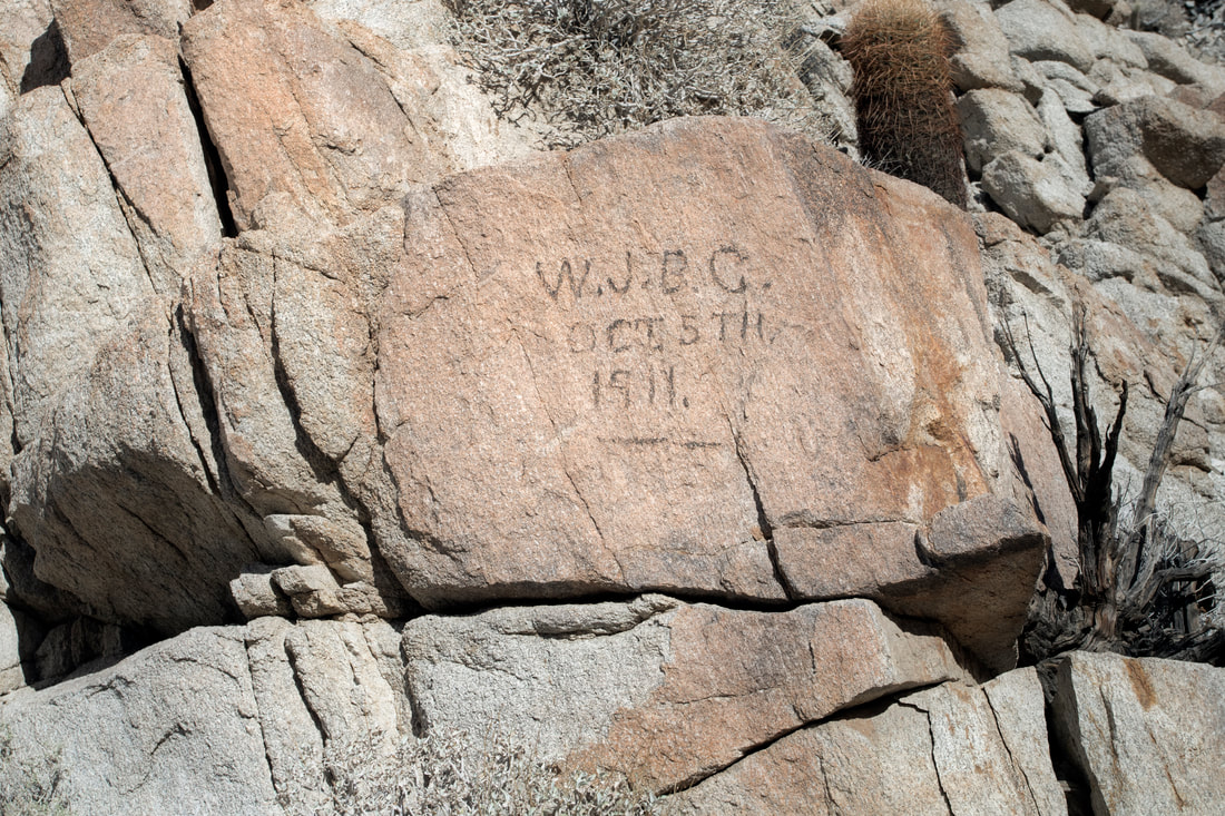
Old Signature, possibly done in axle grease. 1911 alongside the Old Wagon Road Route, though the road is no longer detectable in this area.

The Devils Canyon and Old Wagon Road 1862 
Mountain Springs to Ocotillo

Picture
The View looking down into The Upper area of Devils Canyon
Picture
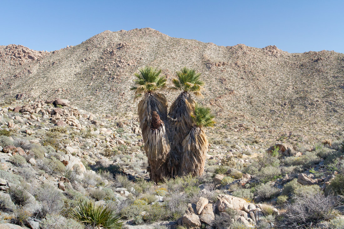
Palm Trees in The Upper reaches of Devils Canyon.
Picture
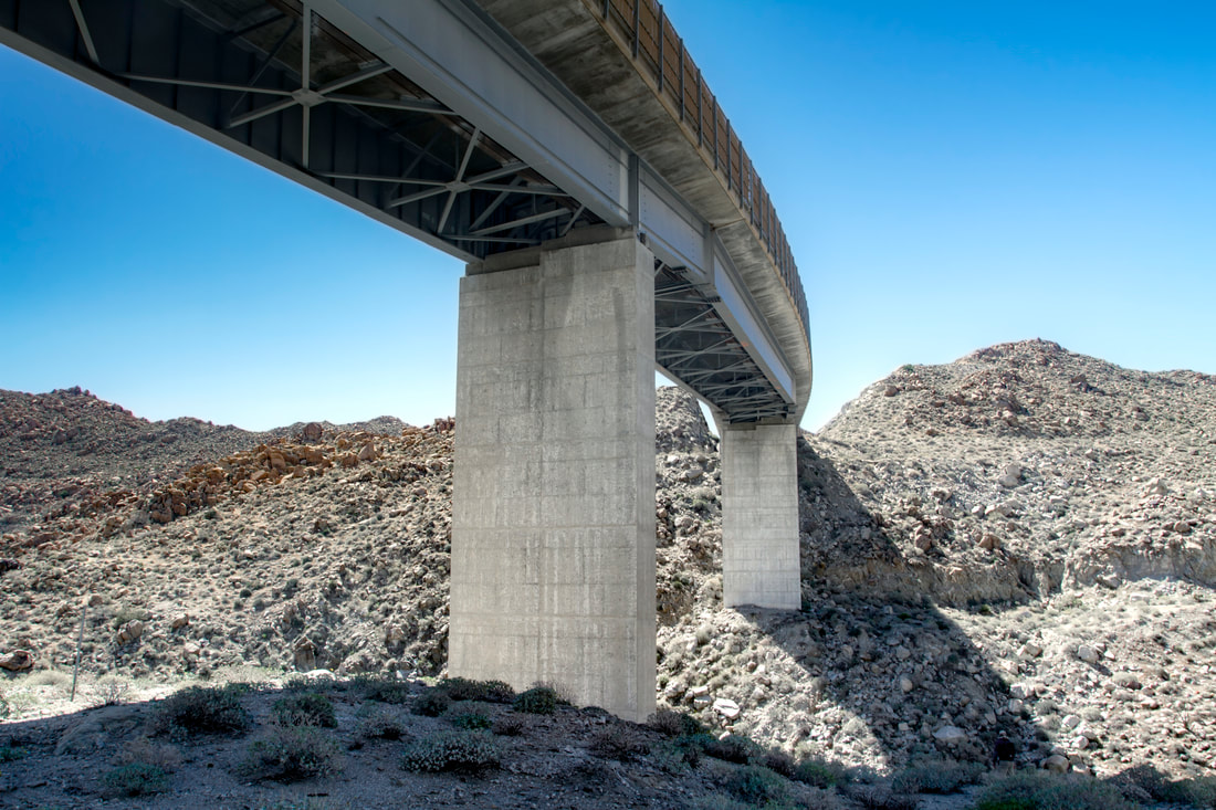
Westernmost Bridge I8W in Devils Canyon.
Picture
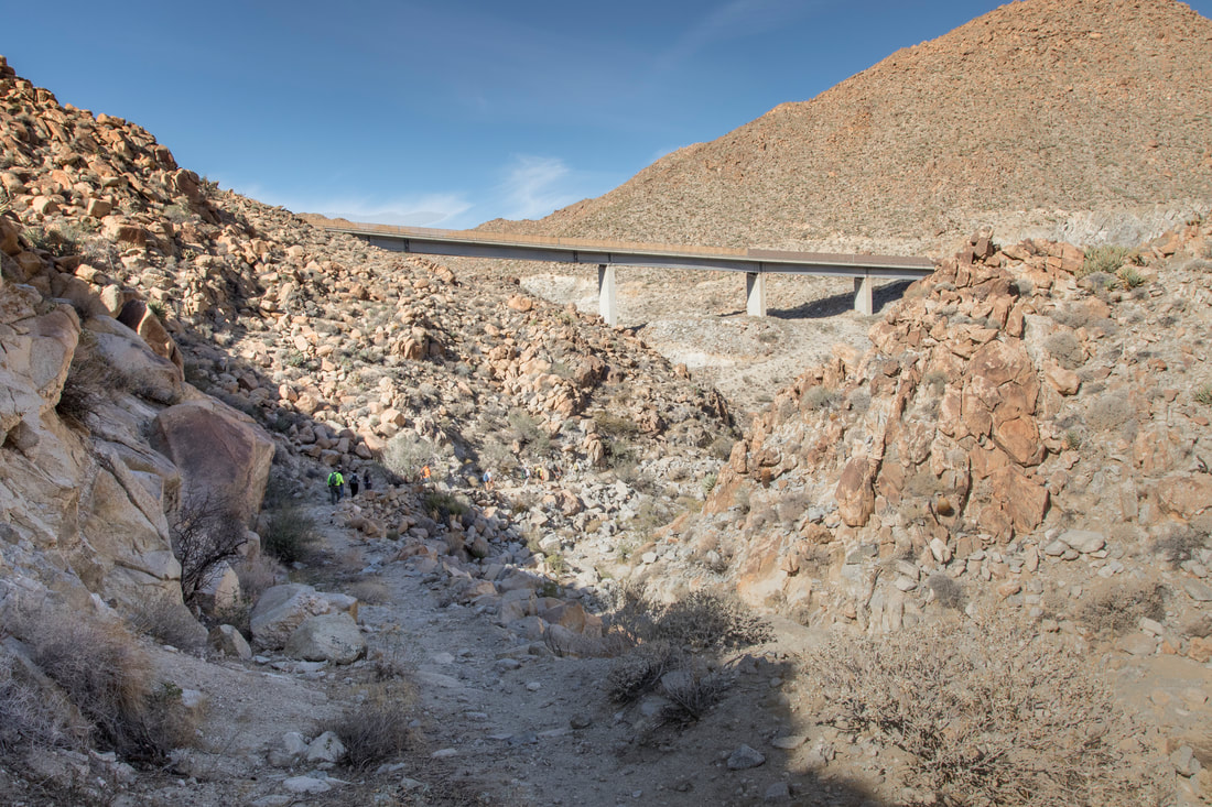
south The Westernmost Bridge I8W , here the Old wagon road hugs the side of The wash and is still discernible. This is the route to and from Mountain View. Heading toward the bridge and under takes you to the uppermost Devils Canyon, or don't go under and follow the wash east and you head toward the Easternmost Bridge and on to Ocotillo.
Picture
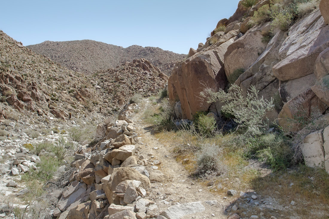
Old Segment of The Wagon Road built around 1862. Most of the road followed close to the wash, this part is above.
Picture
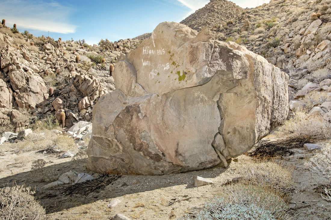
Between the two bridges lies a couple of signs, this one says Higman's Waterhole, possibly water was here in the pass from the drainage behind. would have been a necessity for those traveling up the rough road. Both signs are in the same white paint.
Picture
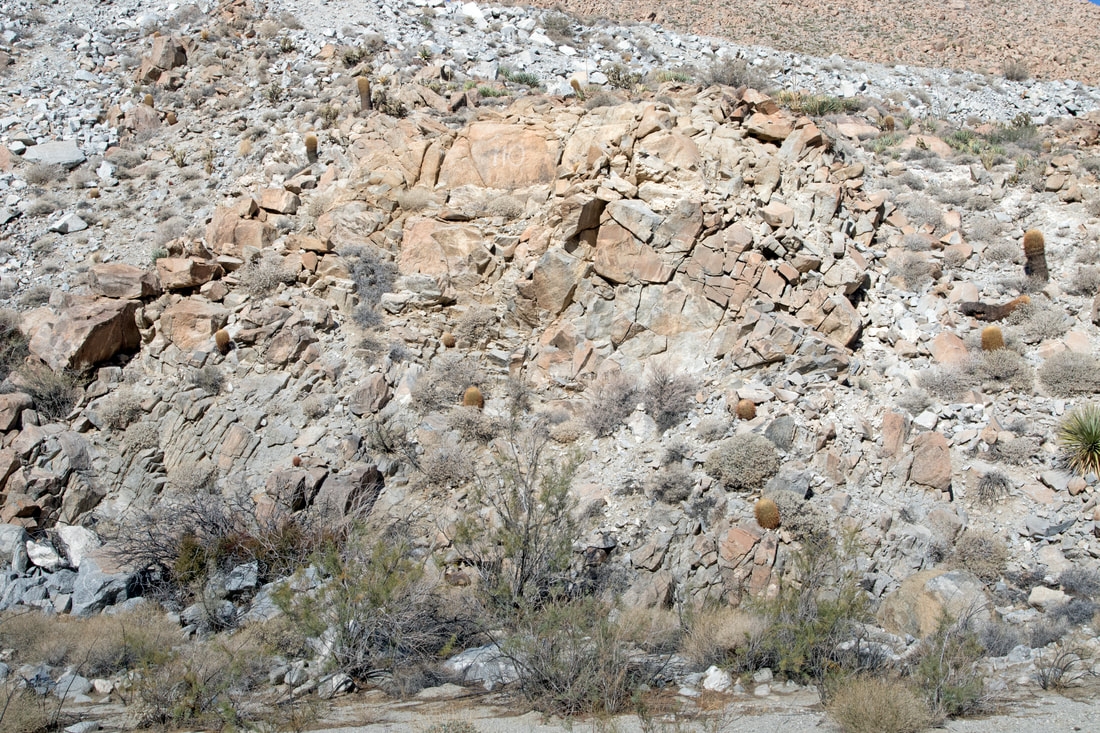
The second sign can be faintly seen above in the rocks and in the next picture, this picture can be enlarged by clicking on it. It is a Simple 110, about the distance to San Diego.
Picture
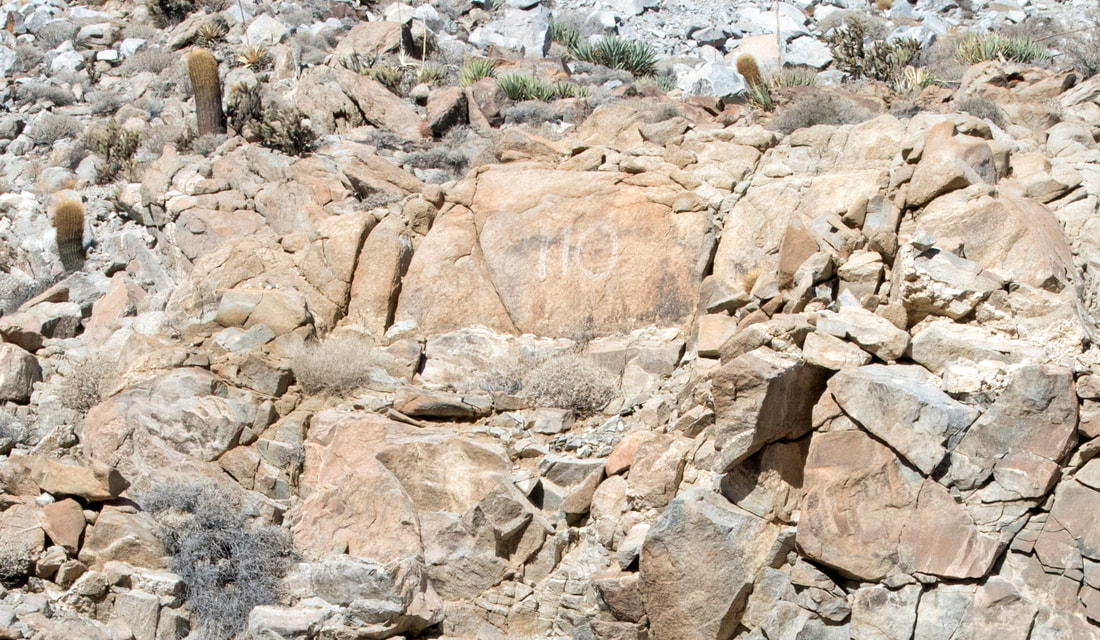
110 in the same paint as Higman's Waterhole
Picture
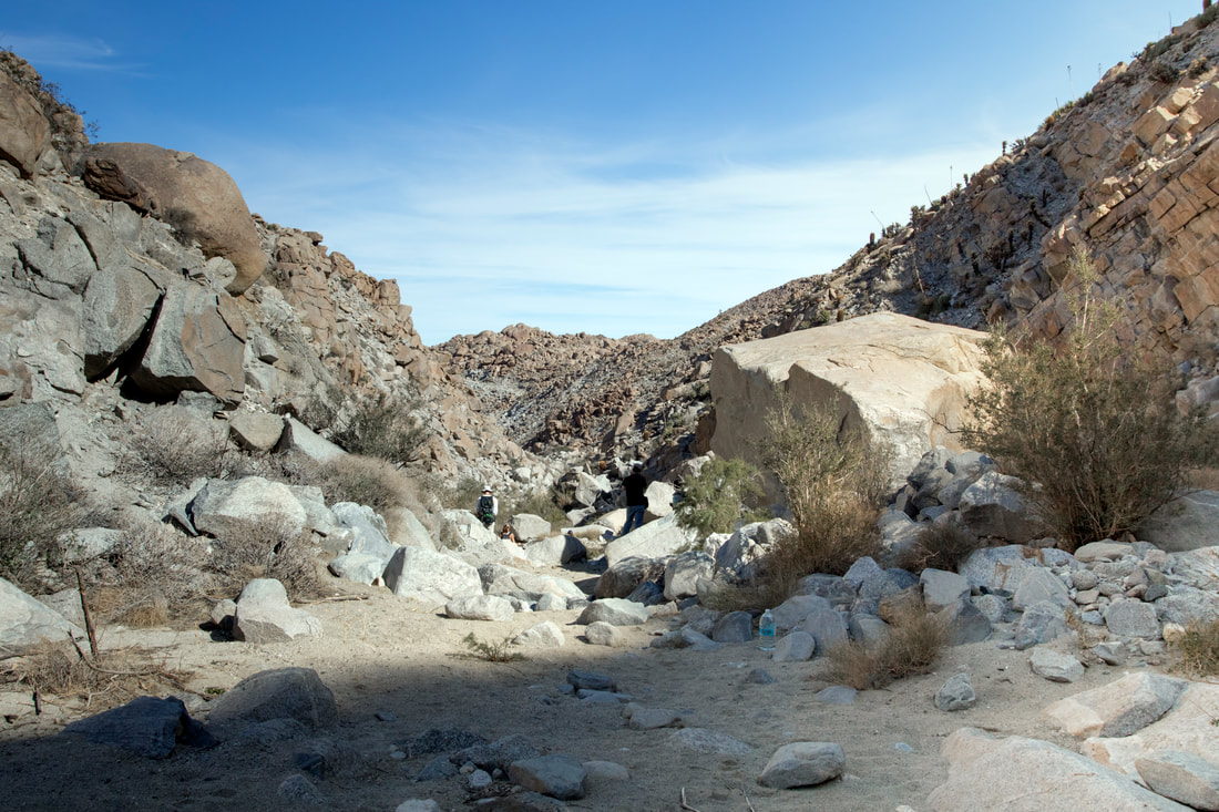
Midway Between the Bridges,in the picture there appears to be a water bottle left behind. The Bottle is not forgotten, throughout the area are left plastic bottles of water for illegal migrants. The water can be the difference between life and death in this area.
Picture
The Bottle of water.
Picture
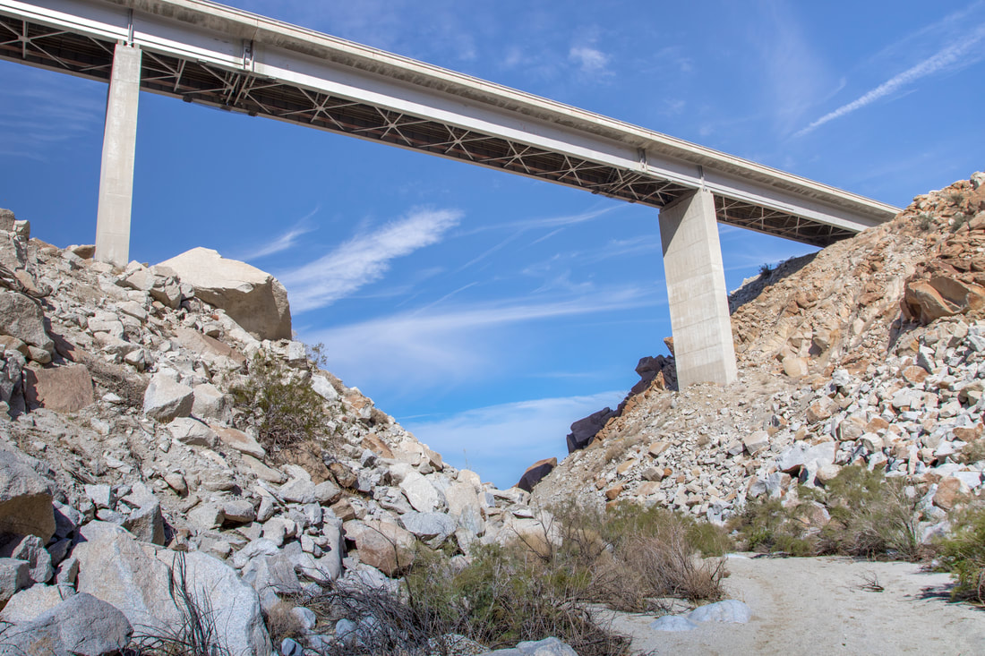
The Southernmost Bridge I8W in Devils Canyon, after this the canyon heads towards Ocotillo.
Picture
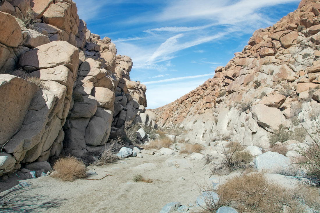
Lower Canyon near Ocotillo 1
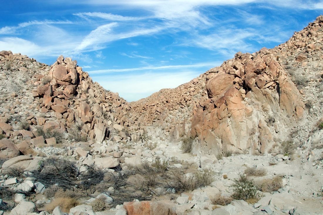
Picture
Lower Canyon 2
Picture
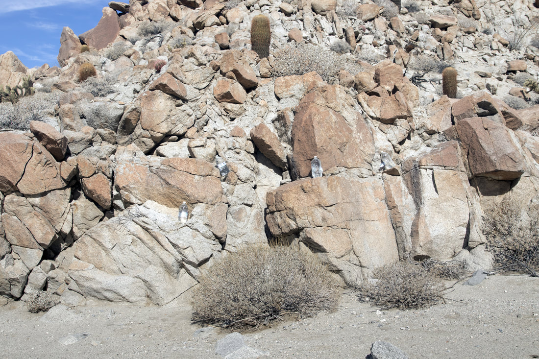
More water bottles for The Illegal Immigrants who would choose this route. These water caches have probably saved many a life. Possibly some hikers as well.

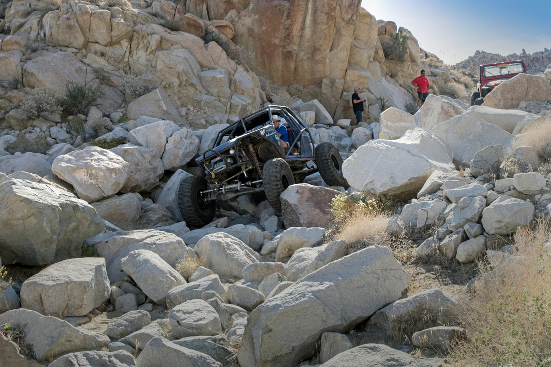
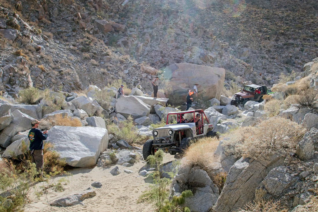
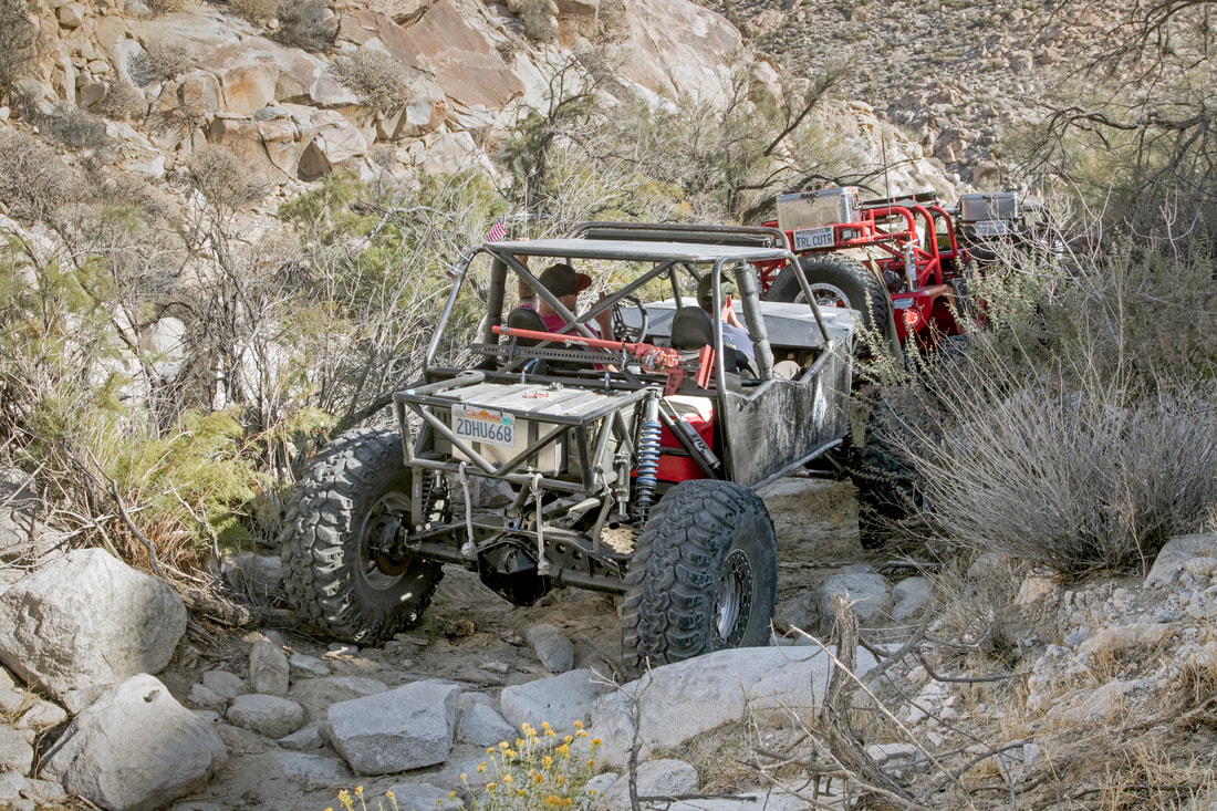
National Public Lands Day
Extreme off Roaders (Permits Required)

Picture
Picture
Picture
Queen Butterflies and Desert Lavendar. 
I apologize for not give out directions to most of my trips, trails change and I do not have the time to keep the site always updated. My hikes also span from the easy to the extreme, a lot of places do not even have trails, as well as extreme conditions. Some sites need to be protected as they are fragile and historically sensitive. So if you decide to hike some of these areas, do your research and know your limits, have the proper provisions .Every year many hikers die  from not understanding these Simple Rules. San Diego County and surrounding areas are diverse in climate and terrain. Remember if you do decide to Hike do your research, carry the essentials and do so at your own risk.  An alternative is to join one of the many hiking groups such as meetup or on facebook ,as well as other social sites. Not only is there safety in numbers but a pooling of knowledge. 
  • Exploring San Diego
  • Day Trips
    • Campo >
      • The Campo Stone Store
      • Campo Pioneer Burial Plots
      • Mystery Rock
      • Rail Road Trestle HWY 94
      • Southern Terminus PCT
      • WWII Pow Chapel
      • Incinerator Camp Lockett
    • Cuyamaca Forest >
      • The Airplane Monument
    • Old Hwy 80 >
      • Boulevard >
        • Masonic Hall Ruins
    • Carlsbad >
      • Mount Calavera
    • Descanso >
      • Ellis Wayside Rest
    • Downtown San Diego >
      • The Old San Diego Jail Cells
    • Escondido >
      • Lake Hodges Dam
    • Jacumba >
      • Mica Gem Mine
      • Carrizo Creek Area
      • Goat Canyon Trestle
      • Happy's Place
      • Jacume
      • Round Mountain
      • Table Mountain
      • Union 76 Sign
      • Valley of The Moon and Vicinity >
        • Border Marker 231
        • Cabin Ruins
        • The Carpet Cave
        • Elliott Mine
        • Smugglers Cave
        • The Antenna Ruins
    • Jamul >
      • Jamul Cement Works
      • Mt. McGinty
    • La Jolla >
      • Kayaking La Jolla
      • Photos La Jolla
      • Sunny Jim Cave
    • Julian >
      • The Warlock Mine
    • Mission Trails Regional Park >
      • Flooding Mission Trails
      • Tree Frogs Season
    • Mountain Springs >
      • Devils Canyon
      • Happy's Camps
      • The Sheep Pens
    • Mount Laguna Area >
      • Pine Valley >
        • Secret Canyon Trail
      • Laguna Meadows >
        • The Pioneer Cemetery
      • Garnet Peak
      • The Pioneer Mail Trail
      • The Pump House
    • Point Loma >
      • Battery E Control Station
      • Bennington Memorial
      • Sea Caves Point Loma
    • Solana Beach >
      • Annies Canyon Trail
  • Forgotten Places
    • Ruin Rancho San Diego
    • Abandone Builldings Lake Morena
    • Abandoned Homestead Site
    • Abandone Home Stead 2
    • The Hidden Cave
    • Bankhead Springs Ghost Town
    • The Forgotten Tunnels
    • Buckman's Springs
    • Old Mines Various
    • Pirates Tower
    • Ghost Signs
    • Manhattan AZ Set
    • School Mine
  • Local WaterFalls
    • Mildred Falls
    • Kitchen Creek Falls
    • Orinoco Creek Falls
    • Three Sisters
    • Storm Canyon Waterfall
    • The Devils Jumpoff
    • Cold Stream Falls
    • Cedar Creek
    • Miadenhair Falls
    • Lake Hodges Falls
    • Waterfalls of Oak Canyon
    • Waterfalls of Cottonwood Creek
    • Green Valley Falls
    • Waterfalls of Chariot Canyon
    • Pinto Canyon Falls
  • Rock Art
    • Anza Borrego 2 Rock Art
    • Cave with No Name
    • Initiation Cave
    • The Lizard Man Cave
    • Petroglyph Site
    • Pictographs November 2012
    • Strange Petroglyphs in Imperial County
    • Rock Art Northern San Diego 1
    • Rock Art Site 2
    • Rock Art Site 3
    • Rock Art Various
    • Unknown Rock Art San Diego County
    • Vallecitos Rock Art
    • Milling Sites >
      • Cuayamaca Ovals
  • Beyond
    • Arizona >
      • Yuma >
        • Bridge to Nowhere
        • Castle Dome Ghost Town
        • Yuma Territorial Prison
    • Imperial County >
      • Anza Borrego >
        • Andrade Canyon
        • Carrizo Mountain
        • The Domelands
        • The Slot
        • Morteros Palms to Goat Canyon
        • Sunrise Butte
        • Yuha Basin
        • Mud Caves
        • Rock House Valley
        • Upper Myers Valley
      • Salton Sea >
        • Mud Volanoes
        • The Old Health Spa
        • Salvation Mountain
    • San Gabriel Mountains >
      • The Bridge to Nowhere
  • The Spooky Side
    • Dead Man's Point
    • Mount Pisquah
    • Pioneer Park
    • Witches Tower
    • Haunted Locations >
      • Hangar One Miramar
      • Julian Hotel
      • Queen Mary >
        • First Class Swimming Pool
        • Water Tight Door 13
      • Vallecitos Stage Station
    • Graves >
      • Grave of Kate Morgan
      • Graves Under San Diego Ave
      • Lady in White Grave
      • The Lonely Grave of Amos Buckman
      • The Forgotten Grave of John Helm
      • Whaley Grave
      • Yankee Jim
  • Hollywood F
  • New Page