EXPLORING SAN DIEGO COUNTY AND BEYOND BY LENS
  • Exploring San Diego
  • Day Trips
    • Campo >
      • The Campo Stone Store
      • Campo Pioneer Burial Plots
      • Mystery Rock
      • Rail Road Trestle HWY 94
      • Southern Terminus PCT
      • WWII Pow Chapel
      • Incinerator Camp Lockett
    • Cuyamaca Forest >
      • The Airplane Monument
    • Old Hwy 80 >
      • Boulevard >
        • Masonic Hall Ruins
    • Carlsbad >
      • Mount Calavera
    • Descanso >
      • Ellis Wayside Rest
    • Downtown San Diego >
      • The Old San Diego Jail Cells
    • Escondido >
      • Lake Hodges Dam
    • Jacumba >
      • Mica Gem Mine
      • Carrizo Creek Area
      • Goat Canyon Trestle
      • Happy's Place
      • Jacume
      • Round Mountain
      • Table Mountain
      • Union 76 Sign
      • Valley of The Moon and Vicinity >
        • Border Marker 231
        • Cabin Ruins
        • The Carpet Cave
        • Elliott Mine
        • Smugglers Cave
        • The Antenna Ruins
    • Jamul >
      • Jamul Cement Works
      • Mt. McGinty
    • La Jolla >
      • Kayaking La Jolla
      • Photos La Jolla
      • Sunny Jim Cave
    • Julian >
      • The Warlock Mine
    • Mission Trails Regional Park >
      • Flooding Mission Trails
      • Tree Frogs Season
    • Mountain Springs >
      • Devils Canyon
      • Happy's Camps
      • The Sheep Pens
    • Mount Laguna Area >
      • Pine Valley >
        • Secret Canyon Trail
      • Laguna Meadows >
        • The Pioneer Cemetery
      • Garnet Peak
      • The Pioneer Mail Trail
      • The Pump House
    • Point Loma >
      • Battery E Control Station
      • Bennington Memorial
      • Sea Caves Point Loma
    • Solana Beach >
      • Annies Canyon Trail
  • Forgotten Places
    • Ruin Rancho San Diego
    • Abandone Builldings Lake Morena
    • Abandoned Homestead Site
    • Abandone Home Stead 2
    • The Hidden Cave
    • Bankhead Springs Ghost Town
    • The Forgotten Tunnels
    • Buckman's Springs
    • Old Mines Various
    • Pirates Tower
    • Ghost Signs
    • Manhattan AZ Set
    • School Mine
  • Local WaterFalls
    • Mildred Falls
    • Kitchen Creek Falls
    • Orinoco Creek Falls
    • Three Sisters
    • Storm Canyon Waterfall
    • The Devils Jumpoff
    • Cold Stream Falls
    • Cedar Creek
    • Miadenhair Falls
    • Lake Hodges Falls
    • Waterfalls of Oak Canyon
    • Waterfalls of Cottonwood Creek
    • Green Valley Falls
    • Waterfalls of Chariot Canyon
    • Pinto Canyon Falls
  • Rock Art
    • Anza Borrego 2 Rock Art
    • Cave with No Name
    • Initiation Cave
    • The Lizard Man Cave
    • Petroglyph Site
    • Pictographs November 2012
    • Strange Petroglyphs in Imperial County
    • Rock Art Northern San Diego 1
    • Rock Art Site 2
    • Rock Art Site 3
    • Rock Art Various
    • Unknown Rock Art San Diego County
    • Vallecitos Rock Art
    • Milling Sites >
      • Cuayamaca Ovals
  • Beyond
    • Arizona >
      • Yuma >
        • Bridge to Nowhere
        • Castle Dome Ghost Town
        • Yuma Territorial Prison
    • Imperial County >
      • Anza Borrego >
        • Andrade Canyon
        • Carrizo Mountain
        • The Domelands
        • The Slot
        • Morteros Palms to Goat Canyon
        • Sunrise Butte
        • Yuha Basin
        • Mud Caves
        • Rock House Valley
        • Upper Myers Valley
      • Salton Sea >
        • Mud Volanoes
        • The Old Health Spa
        • Salvation Mountain
    • San Gabriel Mountains >
      • The Bridge to Nowhere
  • The Spooky Side
    • Dead Man's Point
    • Mount Pisquah
    • Pioneer Park
    • Witches Tower
    • Haunted Locations >
      • Hangar One Miramar
      • Julian Hotel
      • Queen Mary >
        • First Class Swimming Pool
        • Water Tight Door 13
      • Vallecitos Stage Station
    • Graves >
      • Grave of Kate Morgan
      • Graves Under San Diego Ave
      • Lady in White Grave
      • The Lonely Grave of Amos Buckman
      • The Forgotten Grave of John Helm
      • Whaley Grave
      • Yankee Jim
  • Hollywood F
  • New Page

Mud Caves of Arroyo Tapiado

Picture
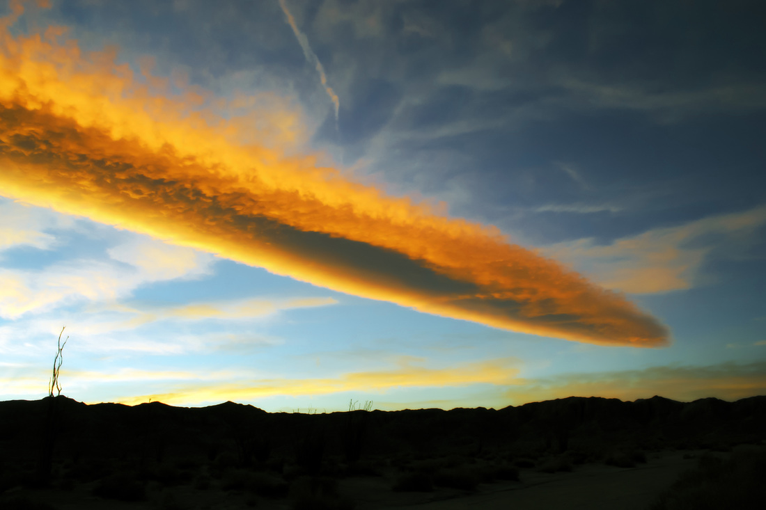
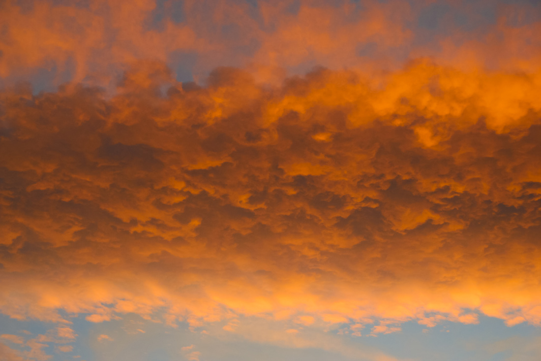
Spent the night camping in Arroyo Tapiado, here's the beautful sunset that night. Looks like a flaming heavenly sword.
Picture

One of the more unusual trips to be found in the Anza Borrego are the Arroyo Tapiado Mud Caves. Though mud caves can be found in other areas, this is one of the largest concentration of over 42 caves. They span the range of large to small, some easy, some difficult.
One must be careful though and beware of ones safety, a recent death in Hidden Cave drives this home. Don't go alone or out of ones comfort zone. The smaller caves should be left to the more experienced.
One also must pay attention to the roads in and out to the Mud Caves, there is quite the off road network in the Anza Borrego, and if you miss your turns you can find yourself in a bit of trouble. The road markers are iffy at best and are sometimes stolen. I will be adding to this page as there is a lot of photos to process. High clearance vehicles  and 4X are the best to travel in. 
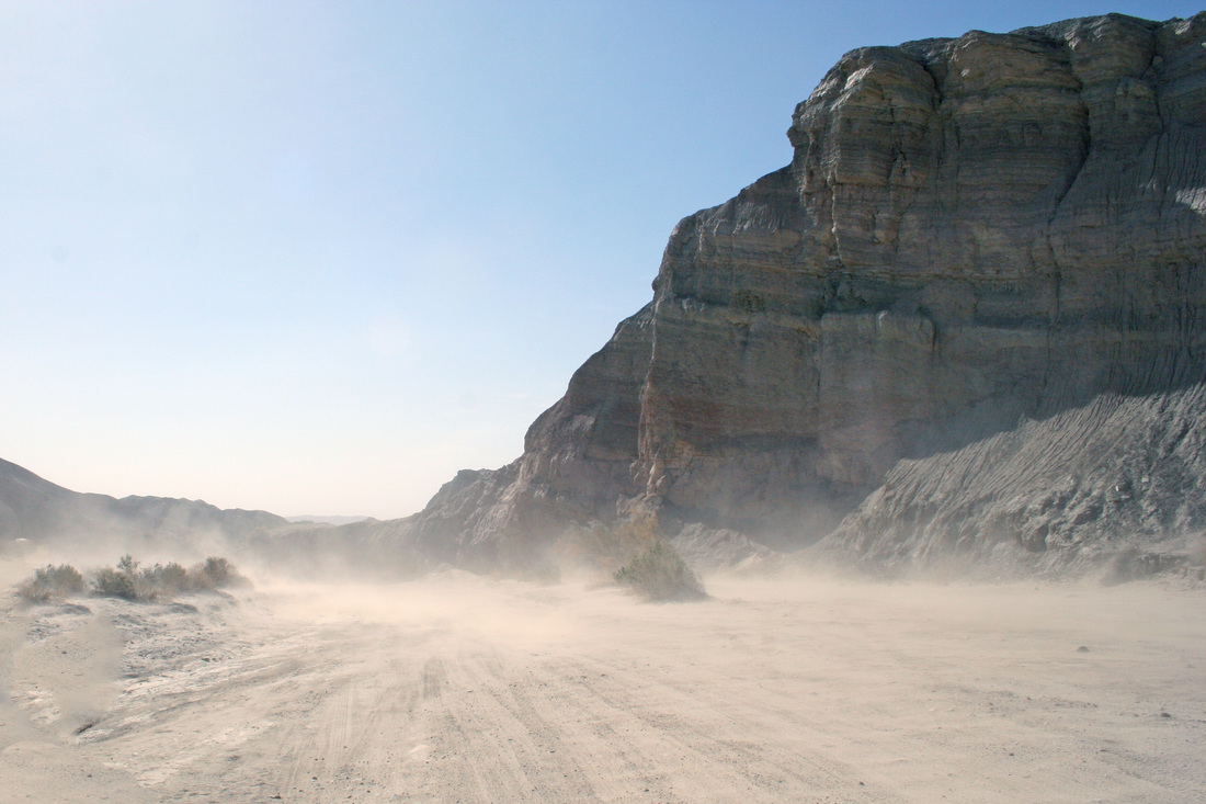
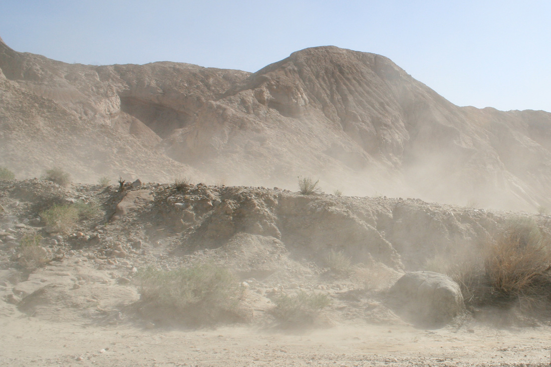
Warning: The area is covered in a extremely fine dust, during winds it really kicks up, see later pictures, in the caves it always present in the air. Anyone with breathing problems need to take precautions.
Two Caves Careys Mud and Chasm, Careys Mud not to be confused with Careys Big Mud, is rommy with huge passages and Chambers. Chasm is still roomy but you need to watch your head in this one.
Picture
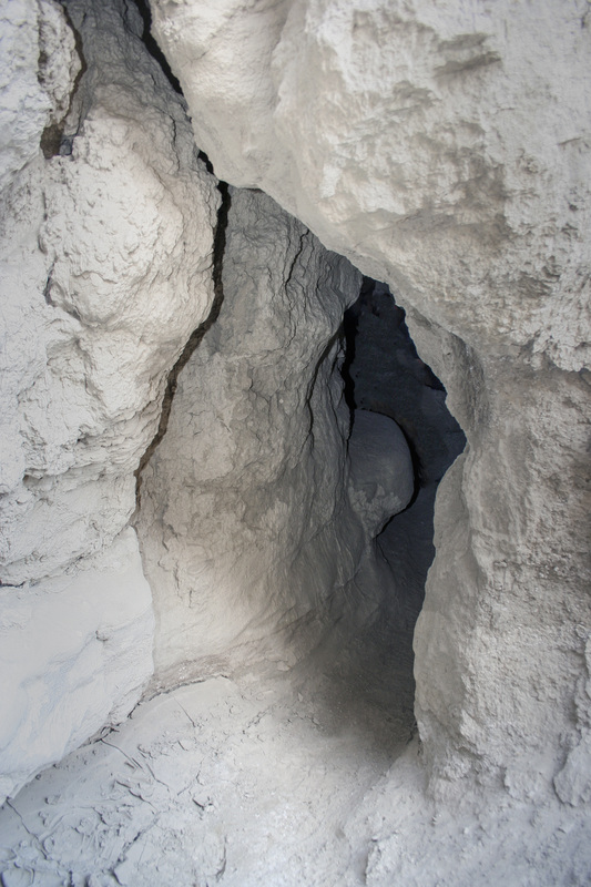
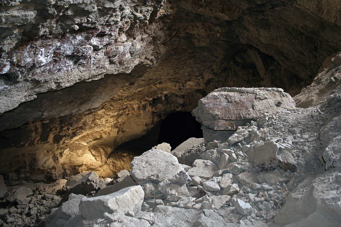
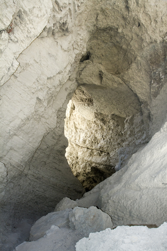
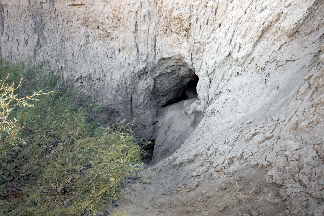
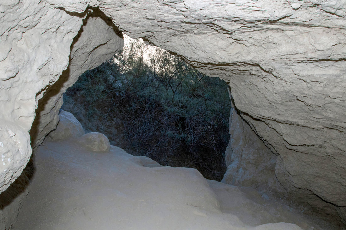
A typical cave entrance.
Picture
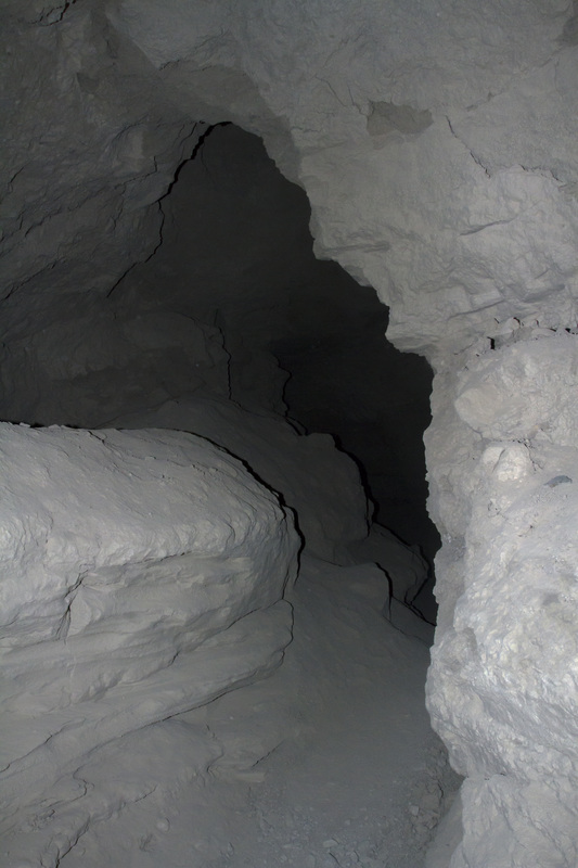
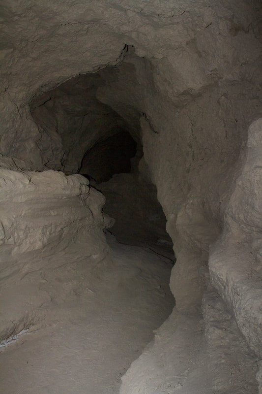
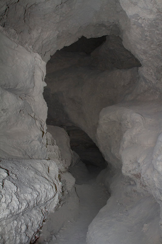
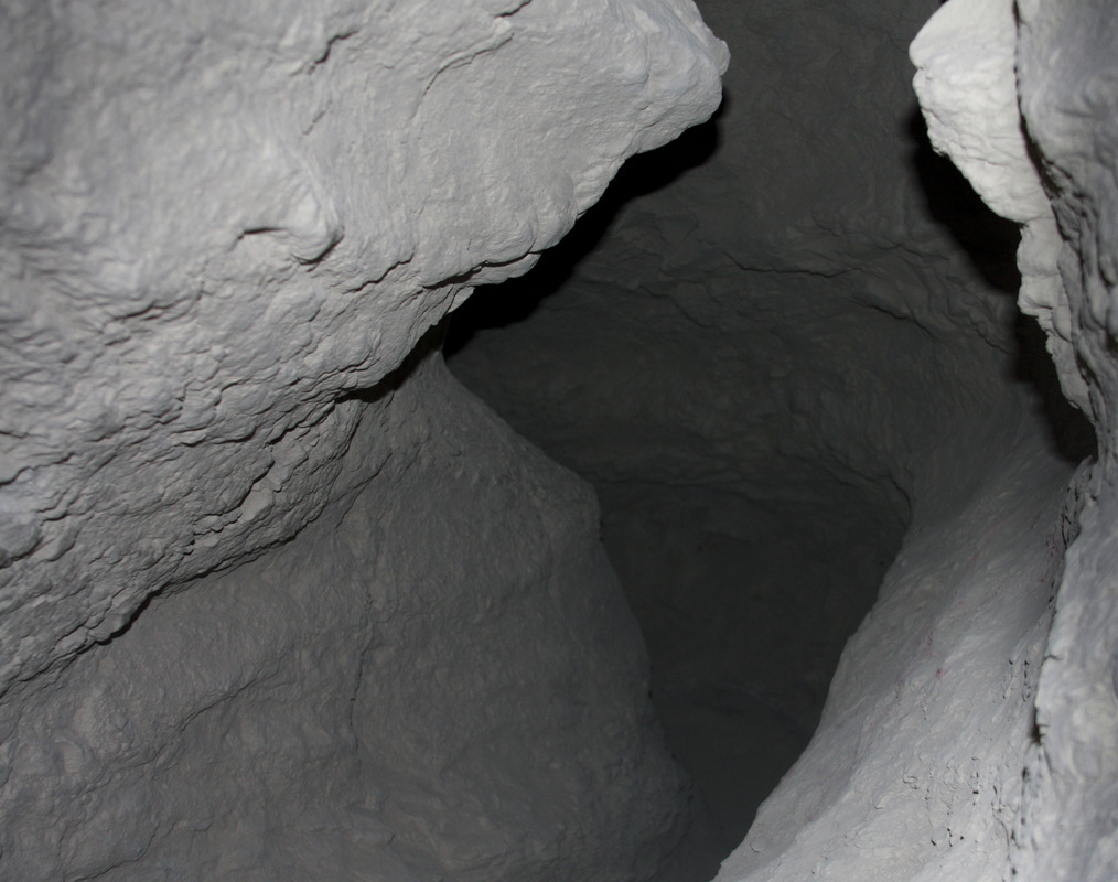
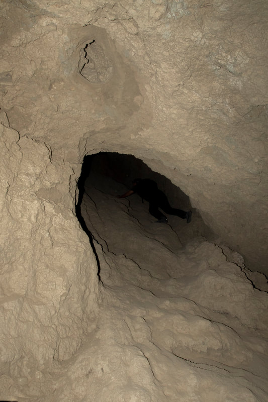
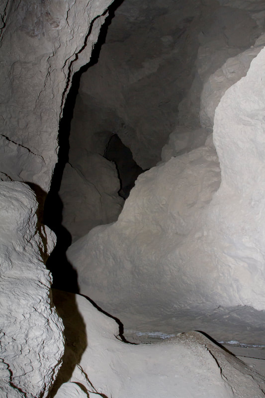
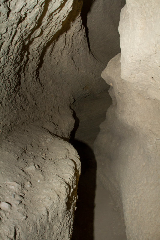
Inside a cave, some caves go on for thousands of feet, others are short sections.
Picture
Picture
Picture
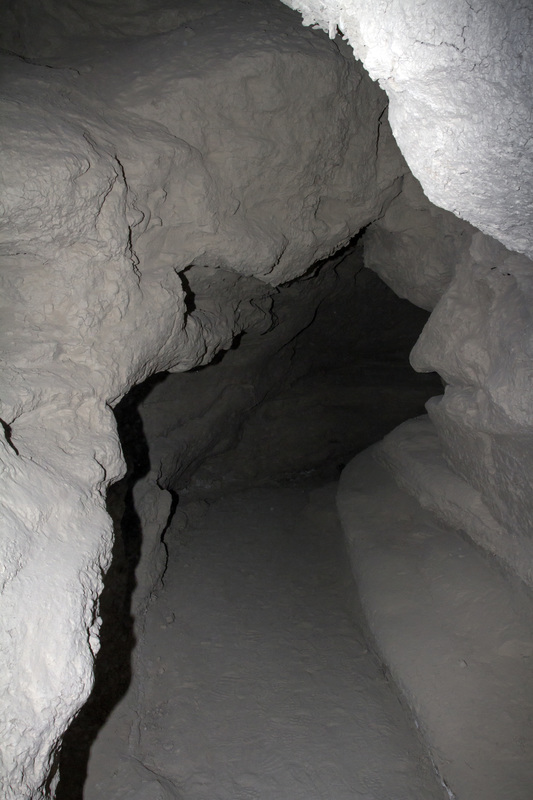
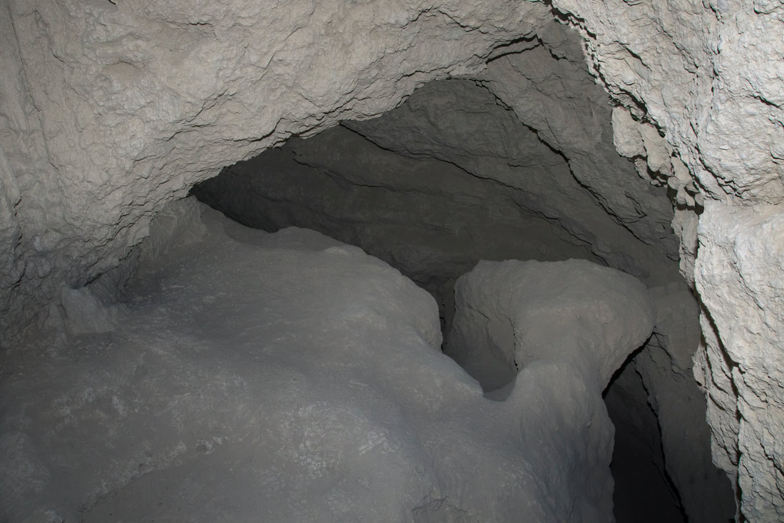
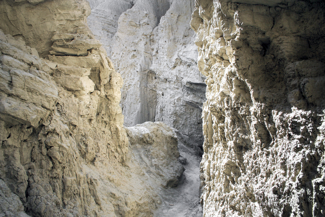
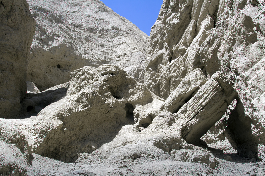
The caves run through the ancient sediment of the ocean that use to cover the area. The sediment that composes the walls, roof and floor is a compacted silt, giving the caves the name mud caves. The silt is of a very fine consistency and the slightest breeze can disturb it.
Picture
Picture
Picture
Picture
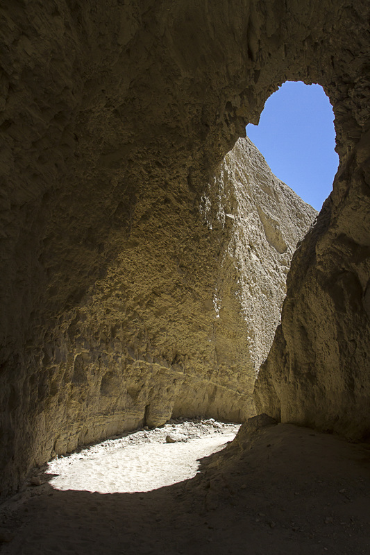
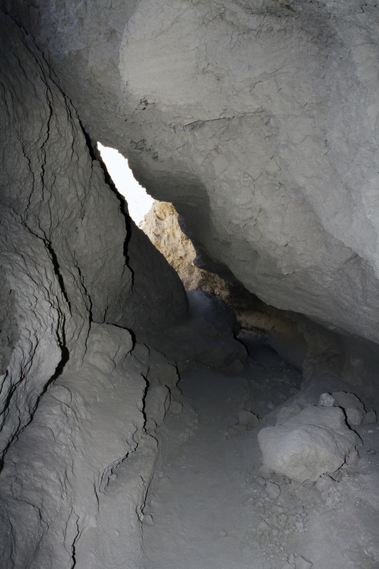
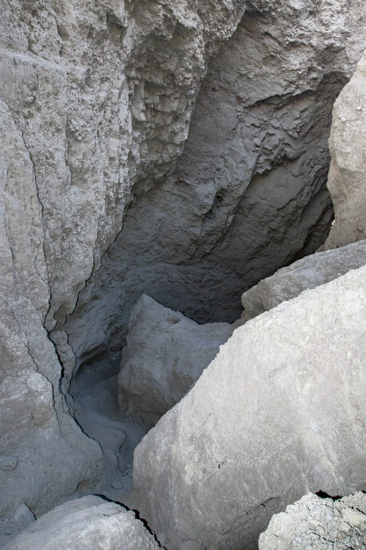
Heres a point of reminder, caves are unpredictable, this section has recently collapsed. This is evident by the light colored rock. The collapse has now created a skylight to the surface. If you look at the picture closely, one can see the point of failure. Though water plays its part, this was most likely caused by the small white crystals on the wall in the background. I have posted a photo of the crystals farther down the page.
Picture
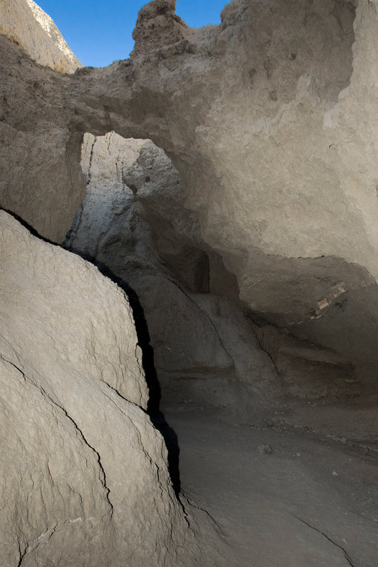
The Exit from Oxbow Cave.
Picture
Picture
Another short section.
Picture
Here's what happens when the wind Blows
Picture
Picture
Picture
Picture
Hidden Cave one of The Dangerous Caves
Picture
Picture
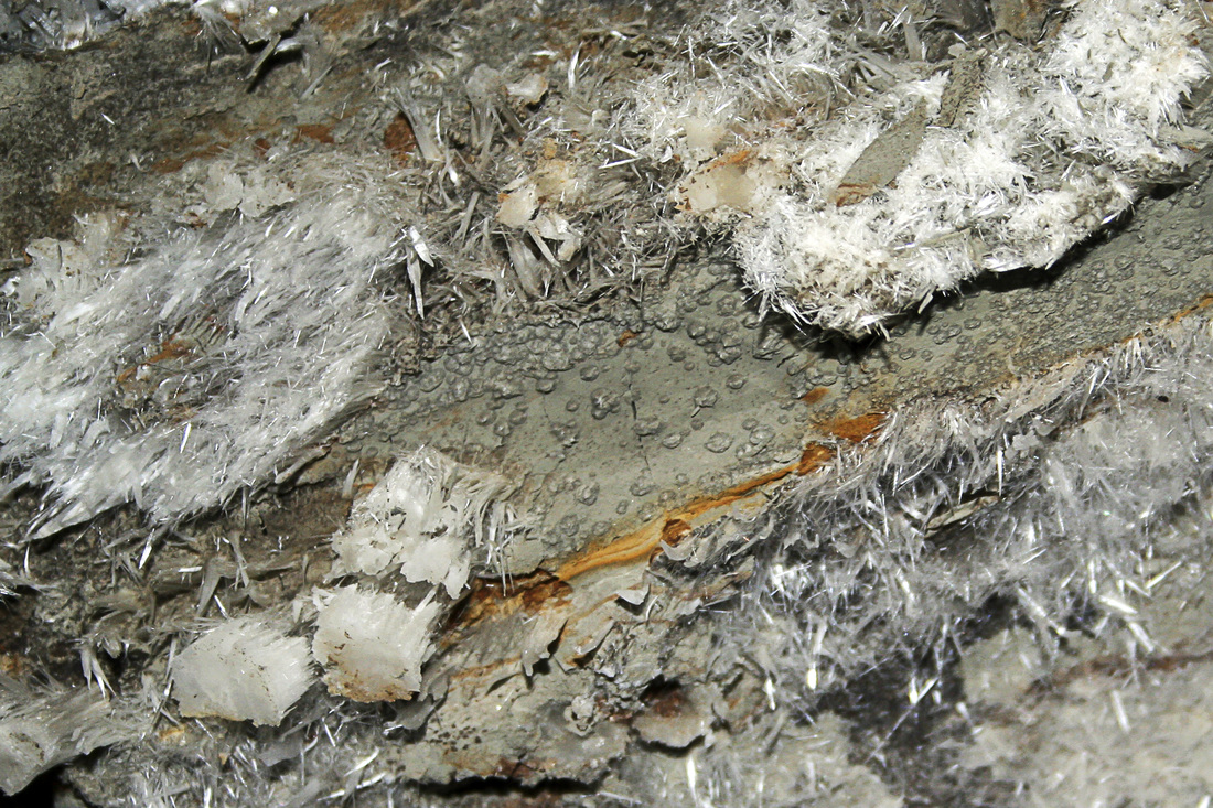
Here's some crystals growing on the wall. They form in the cracks and help in the formation of the caves as they force off sections of the cave.
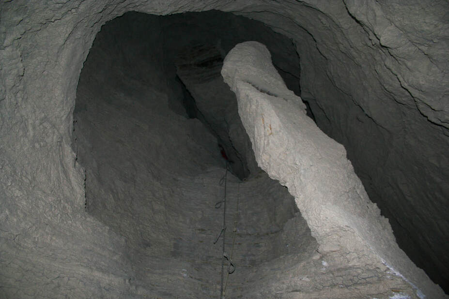
Picture
Exploring a Chimney
Picture
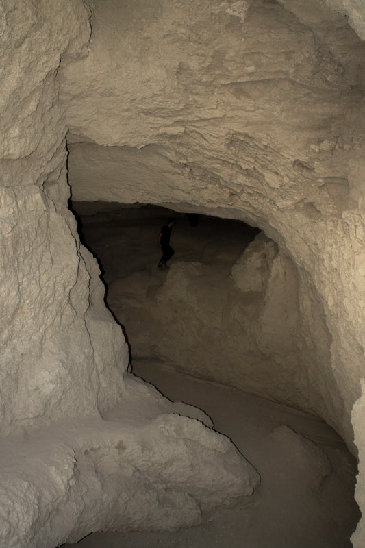
So heres a person within a passage Carey's Mud Cave. Gives you a sense of scale
Picture
Picture
Picture
Picture
Passage in Footprint cave and yes this one is not for The Claustrophopic.
Picture
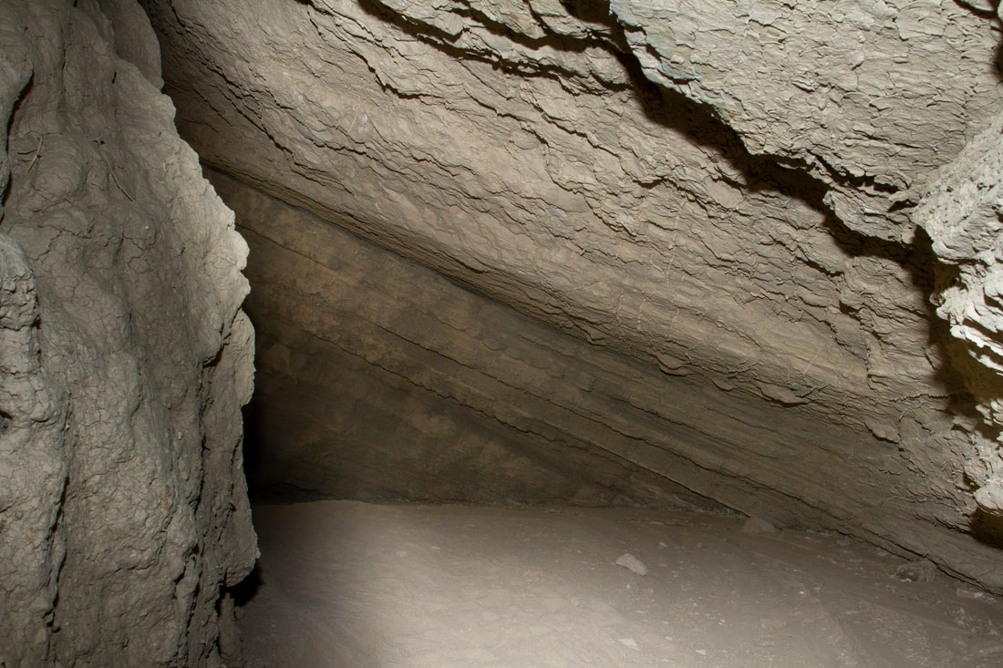
Tilted ancient Marine sediment
I apologize for not give out directions to most of my trips, trails change and I do not have the time to keep the site always updated. My hikes also span from the easy to the extreme, a lot of places do not even have trails, as well as extreme conditions. Some sites need to be protected as they are fragile and historically sensitive. So if you decide to hike some of these areas, do your research and know your limits, have the proper provisions .Every year many hikers die  from not understanding these Simple Rules. San Diego County and surrounding areas are diverse in climate and terrain. Remember if you do decide to Hike do your research, carry the essentials and do so at your own risk.  An alternative is to join one of the many hiking groups such as meetup or on facebook ,as well as other social sites. Not only is there safety in numbers but a pooling of knowledge. 
  • Exploring San Diego
  • Day Trips
    • Campo >
      • The Campo Stone Store
      • Campo Pioneer Burial Plots
      • Mystery Rock
      • Rail Road Trestle HWY 94
      • Southern Terminus PCT
      • WWII Pow Chapel
      • Incinerator Camp Lockett
    • Cuyamaca Forest >
      • The Airplane Monument
    • Old Hwy 80 >
      • Boulevard >
        • Masonic Hall Ruins
    • Carlsbad >
      • Mount Calavera
    • Descanso >
      • Ellis Wayside Rest
    • Downtown San Diego >
      • The Old San Diego Jail Cells
    • Escondido >
      • Lake Hodges Dam
    • Jacumba >
      • Mica Gem Mine
      • Carrizo Creek Area
      • Goat Canyon Trestle
      • Happy's Place
      • Jacume
      • Round Mountain
      • Table Mountain
      • Union 76 Sign
      • Valley of The Moon and Vicinity >
        • Border Marker 231
        • Cabin Ruins
        • The Carpet Cave
        • Elliott Mine
        • Smugglers Cave
        • The Antenna Ruins
    • Jamul >
      • Jamul Cement Works
      • Mt. McGinty
    • La Jolla >
      • Kayaking La Jolla
      • Photos La Jolla
      • Sunny Jim Cave
    • Julian >
      • The Warlock Mine
    • Mission Trails Regional Park >
      • Flooding Mission Trails
      • Tree Frogs Season
    • Mountain Springs >
      • Devils Canyon
      • Happy's Camps
      • The Sheep Pens
    • Mount Laguna Area >
      • Pine Valley >
        • Secret Canyon Trail
      • Laguna Meadows >
        • The Pioneer Cemetery
      • Garnet Peak
      • The Pioneer Mail Trail
      • The Pump House
    • Point Loma >
      • Battery E Control Station
      • Bennington Memorial
      • Sea Caves Point Loma
    • Solana Beach >
      • Annies Canyon Trail
  • Forgotten Places
    • Ruin Rancho San Diego
    • Abandone Builldings Lake Morena
    • Abandoned Homestead Site
    • Abandone Home Stead 2
    • The Hidden Cave
    • Bankhead Springs Ghost Town
    • The Forgotten Tunnels
    • Buckman's Springs
    • Old Mines Various
    • Pirates Tower
    • Ghost Signs
    • Manhattan AZ Set
    • School Mine
  • Local WaterFalls
    • Mildred Falls
    • Kitchen Creek Falls
    • Orinoco Creek Falls
    • Three Sisters
    • Storm Canyon Waterfall
    • The Devils Jumpoff
    • Cold Stream Falls
    • Cedar Creek
    • Miadenhair Falls
    • Lake Hodges Falls
    • Waterfalls of Oak Canyon
    • Waterfalls of Cottonwood Creek
    • Green Valley Falls
    • Waterfalls of Chariot Canyon
    • Pinto Canyon Falls
  • Rock Art
    • Anza Borrego 2 Rock Art
    • Cave with No Name
    • Initiation Cave
    • The Lizard Man Cave
    • Petroglyph Site
    • Pictographs November 2012
    • Strange Petroglyphs in Imperial County
    • Rock Art Northern San Diego 1
    • Rock Art Site 2
    • Rock Art Site 3
    • Rock Art Various
    • Unknown Rock Art San Diego County
    • Vallecitos Rock Art
    • Milling Sites >
      • Cuayamaca Ovals
  • Beyond
    • Arizona >
      • Yuma >
        • Bridge to Nowhere
        • Castle Dome Ghost Town
        • Yuma Territorial Prison
    • Imperial County >
      • Anza Borrego >
        • Andrade Canyon
        • Carrizo Mountain
        • The Domelands
        • The Slot
        • Morteros Palms to Goat Canyon
        • Sunrise Butte
        • Yuha Basin
        • Mud Caves
        • Rock House Valley
        • Upper Myers Valley
      • Salton Sea >
        • Mud Volanoes
        • The Old Health Spa
        • Salvation Mountain
    • San Gabriel Mountains >
      • The Bridge to Nowhere
  • The Spooky Side
    • Dead Man's Point
    • Mount Pisquah
    • Pioneer Park
    • Witches Tower
    • Haunted Locations >
      • Hangar One Miramar
      • Julian Hotel
      • Queen Mary >
        • First Class Swimming Pool
        • Water Tight Door 13
      • Vallecitos Stage Station
    • Graves >
      • Grave of Kate Morgan
      • Graves Under San Diego Ave
      • Lady in White Grave
      • The Lonely Grave of Amos Buckman
      • The Forgotten Grave of John Helm
      • Whaley Grave
      • Yankee Jim
  • Hollywood F
  • New Page