EXPLORING SAN DIEGO COUNTY AND BEYOND BY LENS
  • Exploring San Diego
  • Day Trips
    • Campo >
      • The Campo Stone Store
      • Campo Pioneer Burial Plots
      • Mystery Rock
      • Rail Road Trestle HWY 94
      • Southern Terminus PCT
      • WWII Pow Chapel
      • Incinerator Camp Lockett
    • Cuyamaca Forest >
      • The Airplane Monument
    • Old Hwy 80 >
      • Boulevard >
        • Masonic Hall Ruins
    • Carlsbad >
      • Mount Calavera
    • Descanso >
      • Ellis Wayside Rest
    • Downtown San Diego >
      • The Old San Diego Jail Cells
    • Escondido >
      • Lake Hodges Dam
    • Jacumba >
      • Mica Gem Mine
      • Carrizo Creek Area
      • Goat Canyon Trestle
      • Happy's Place
      • Jacume
      • Round Mountain
      • Table Mountain
      • Union 76 Sign
      • Valley of The Moon and Vicinity >
        • Border Marker 231
        • Cabin Ruins
        • The Carpet Cave
        • Elliott Mine
        • Smugglers Cave
        • The Antenna Ruins
    • Jamul >
      • Jamul Cement Works
      • Mt. McGinty
    • La Jolla >
      • Kayaking La Jolla
      • Photos La Jolla
      • Sunny Jim Cave
    • Julian >
      • The Warlock Mine
    • Mission Trails Regional Park >
      • Flooding Mission Trails
      • Tree Frogs Season
    • Mountain Springs >
      • Devils Canyon
      • Happy's Camps
      • The Sheep Pens
    • Mount Laguna Area >
      • Pine Valley >
        • Secret Canyon Trail
      • Laguna Meadows >
        • The Pioneer Cemetery
      • Garnet Peak
      • The Pioneer Mail Trail
      • The Pump House
    • Point Loma >
      • Battery E Control Station
      • Bennington Memorial
      • Sea Caves Point Loma
    • Solana Beach >
      • Annies Canyon Trail
  • Forgotten Places
    • Ruin Rancho San Diego
    • Abandone Builldings Lake Morena
    • Abandoned Homestead Site
    • Abandone Home Stead 2
    • The Hidden Cave
    • Bankhead Springs Ghost Town
    • The Forgotten Tunnels
    • Buckman's Springs
    • Old Mines Various
    • Pirates Tower
    • Ghost Signs
    • Manhattan AZ Set
    • School Mine
  • Local WaterFalls
    • Mildred Falls
    • Kitchen Creek Falls
    • Orinoco Creek Falls
    • Three Sisters
    • Storm Canyon Waterfall
    • The Devils Jumpoff
    • Cold Stream Falls
    • Cedar Creek
    • Miadenhair Falls
    • Lake Hodges Falls
    • Waterfalls of Oak Canyon
    • Waterfalls of Cottonwood Creek
    • Green Valley Falls
    • Waterfalls of Chariot Canyon
    • Pinto Canyon Falls
  • Rock Art
    • Anza Borrego 2 Rock Art
    • Cave with No Name
    • Initiation Cave
    • The Lizard Man Cave
    • Petroglyph Site
    • Pictographs November 2012
    • Strange Petroglyphs in Imperial County
    • Rock Art Northern San Diego 1
    • Rock Art Site 2
    • Rock Art Site 3
    • Rock Art Various
    • Unknown Rock Art San Diego County
    • Vallecitos Rock Art
    • Milling Sites >
      • Cuayamaca Ovals
  • Beyond
    • Arizona >
      • Yuma >
        • Bridge to Nowhere
        • Castle Dome Ghost Town
        • Yuma Territorial Prison
    • Imperial County >
      • Anza Borrego >
        • Andrade Canyon
        • Carrizo Mountain
        • The Domelands
        • The Slot
        • Morteros Palms to Goat Canyon
        • Sunrise Butte
        • Yuha Basin
        • Mud Caves
        • Rock House Valley
        • Upper Myers Valley
      • Salton Sea >
        • Mud Volanoes
        • The Old Health Spa
        • Salvation Mountain
    • San Gabriel Mountains >
      • The Bridge to Nowhere
  • The Spooky Side
    • Dead Man's Point
    • Mount Pisquah
    • Pioneer Park
    • Witches Tower
    • Haunted Locations >
      • Hangar One Miramar
      • Julian Hotel
      • Queen Mary >
        • First Class Swimming Pool
        • Water Tight Door 13
      • Vallecitos Stage Station
    • Graves >
      • Grave of Kate Morgan
      • Graves Under San Diego Ave
      • Lady in White Grave
      • The Lonely Grave of Amos Buckman
      • The Forgotten Grave of John Helm
      • Whaley Grave
      • Yankee Jim
  • Hollywood F
  • New Page

Pictographs November 2014 (First Shelter)

Picture
The Three Rock Shelters on this page are all in near vicinity to each other and are most likely associated.
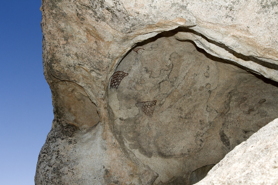
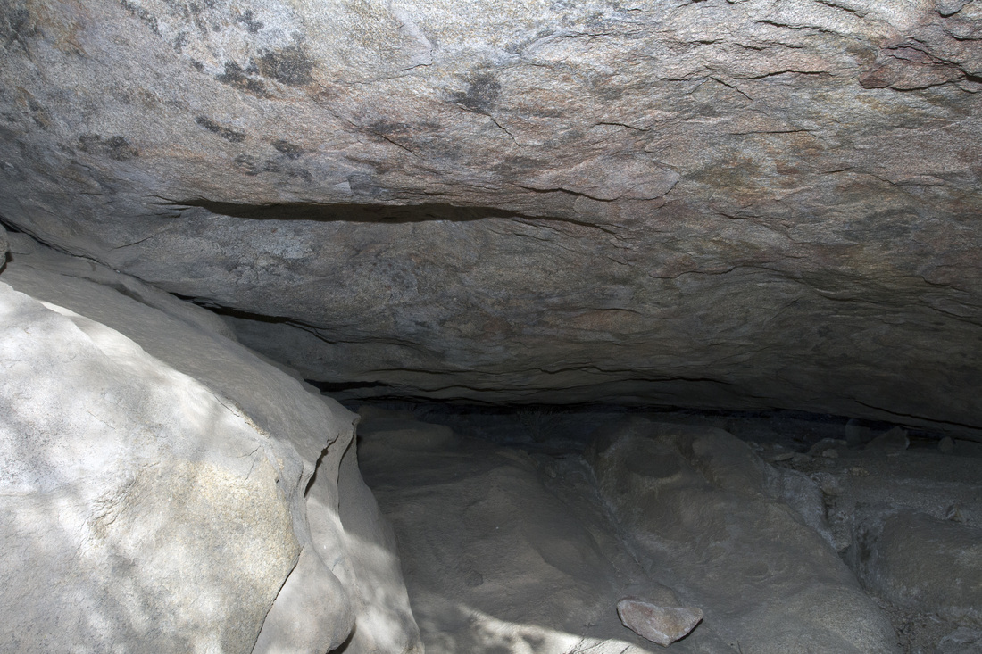
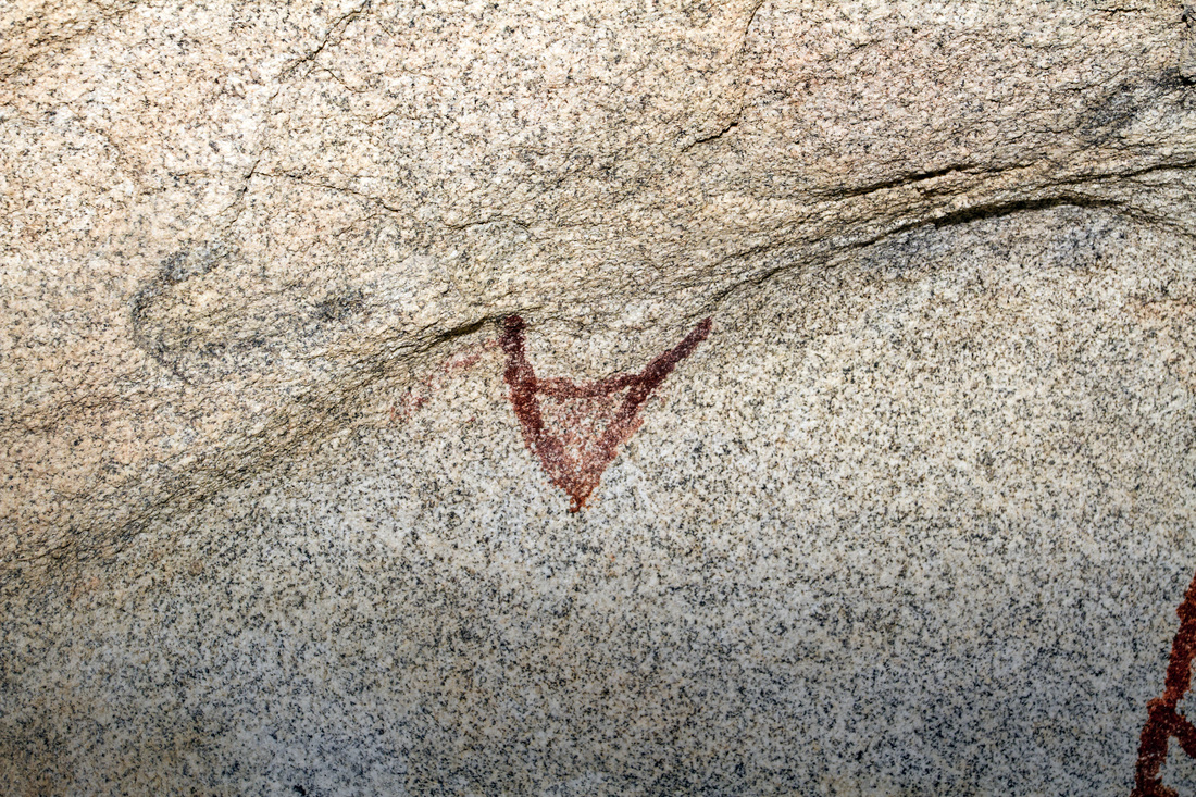
The First Rock Shelter is found amongst a jumble of stones, it consist of a boulder hollowed out beneath. There is a separation cause by the underlying rock which separates it into two chambers. Both face into an easterly direction, toward the rising of the morning sun. In the above photo can be seen 3 distinct Red Pictographs, in very good condition.
Picture
Picture
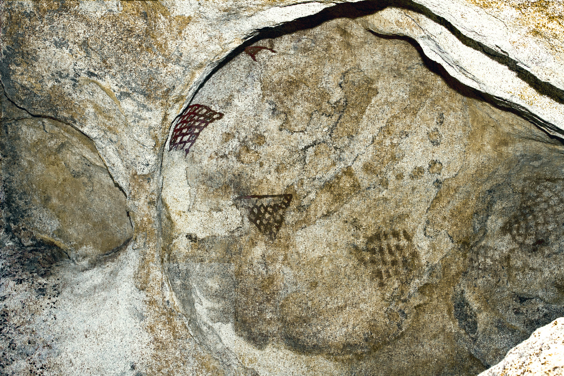
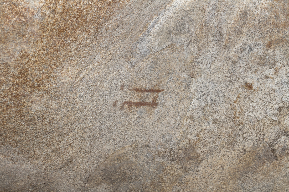
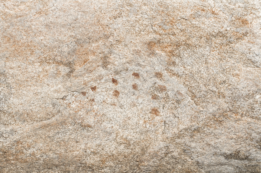
Enhanced the Images a bit with Photoshop,the pictographs that are sheltered from the elements hold up well, but there's hints of others that fared less well.
Picture
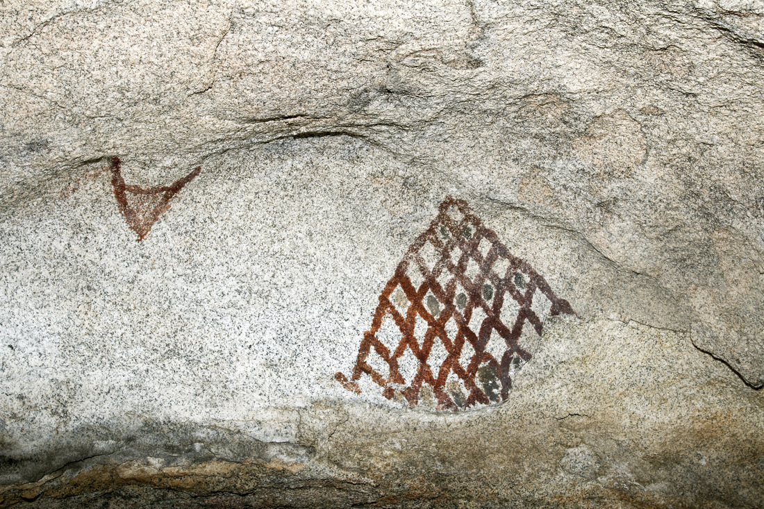
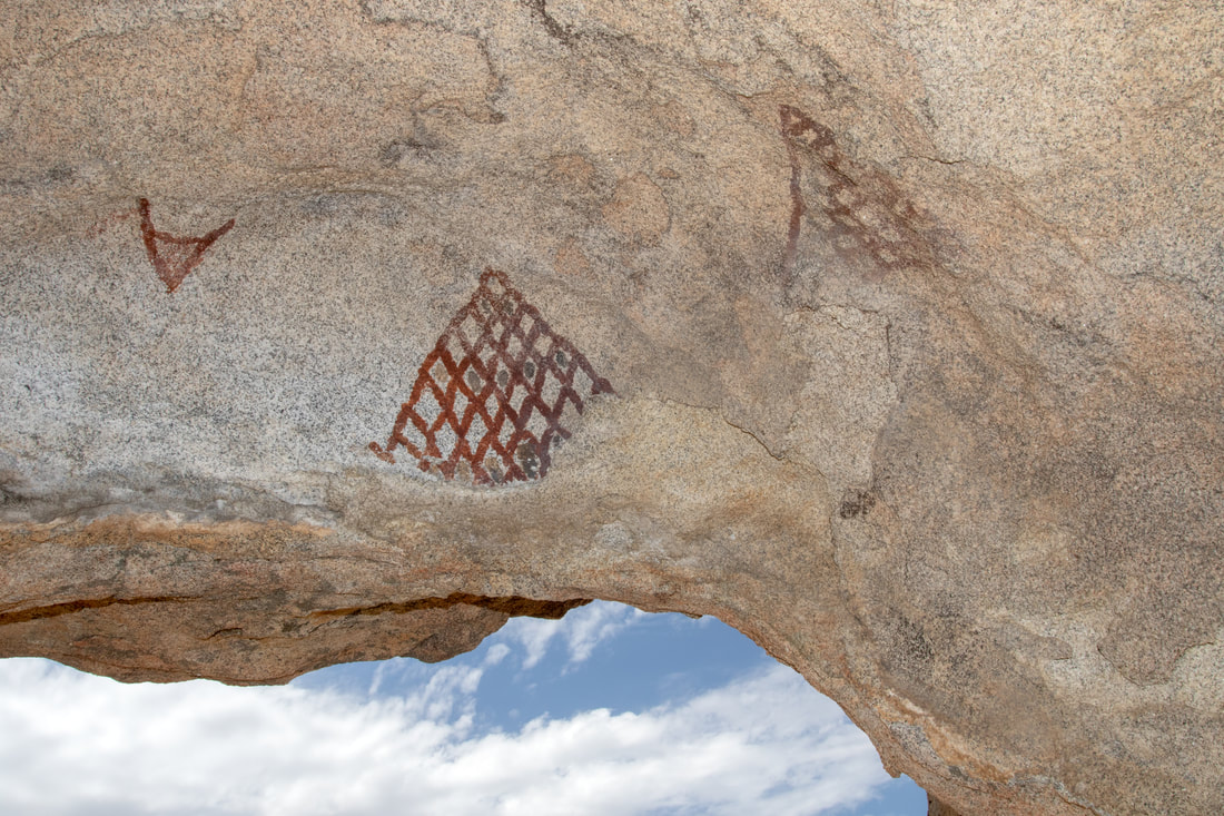
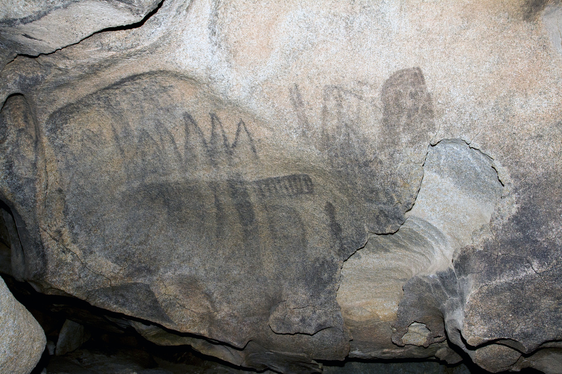
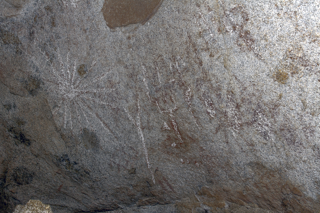
Above is a close up  of the Forward Caves three petroglyphs, the two beneath the caves lip are in better condition.  Though the net shape one seems to have a piece missing. notice the black dots within some of the triangles.
Picture
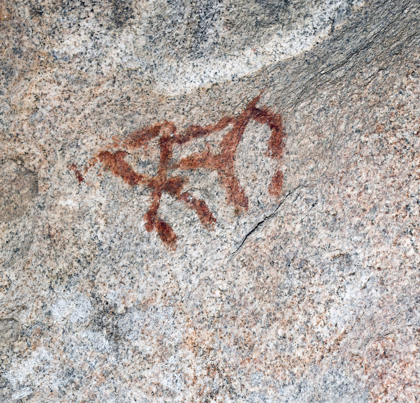
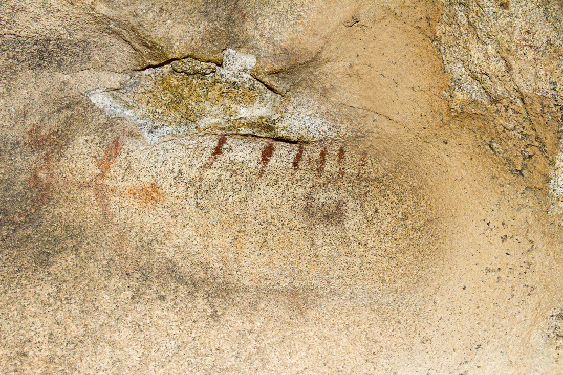
The Back end of the Cave beyond the divider has what appears to be an animal type red Pictograph and two more faded oictographs, one consisting of some red lines, the other some faded red dots
Picture
Picture
Picture
Picture

Picture
Picture

The Second Rock Shelter

Picture
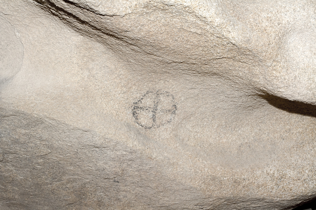
Coming to a large Jumble of boulders, there is another Rock Shelter within. The circle and cross is at the entrance and the large somber panel within. The main chamber western wall is open to a western panorama of mountains and setting sun. The Panel is of a dark color and very faded, it is still quite impressive. There appears to be a section that may have been pilfered as there are no stone fragments lying on the ground.
Picture
Above is a Worn petroglyph, it is located in the ceiling, This is looking straight up into it
Picture
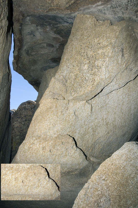
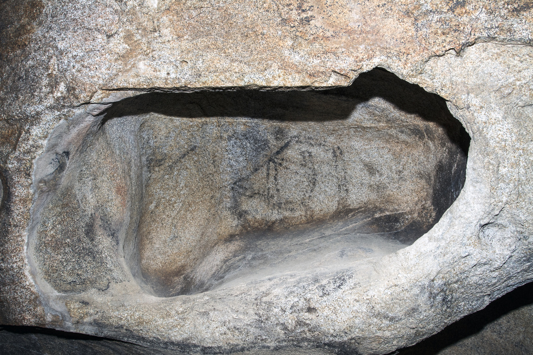
In This Photo there is what appear to be Cupules, Cupules are one of the oldest forms of rock art. They can be easily confused with natural occurring depressions, but in this case there location and concentration tend to point to rock art.

Picture
A shield symbol hangs over one of the entryways

The Third Shelter

Picture
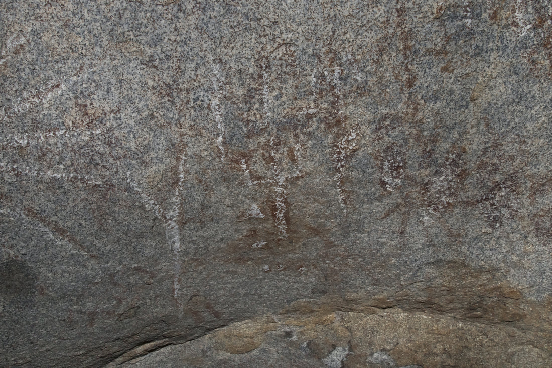
The Third Shelter is close  to a settled area, and is easily accessible. I have darkened the photos as it is easier to see them. Unfortunately for the pictographs, they have been worn away and are extremely faded.


Picture
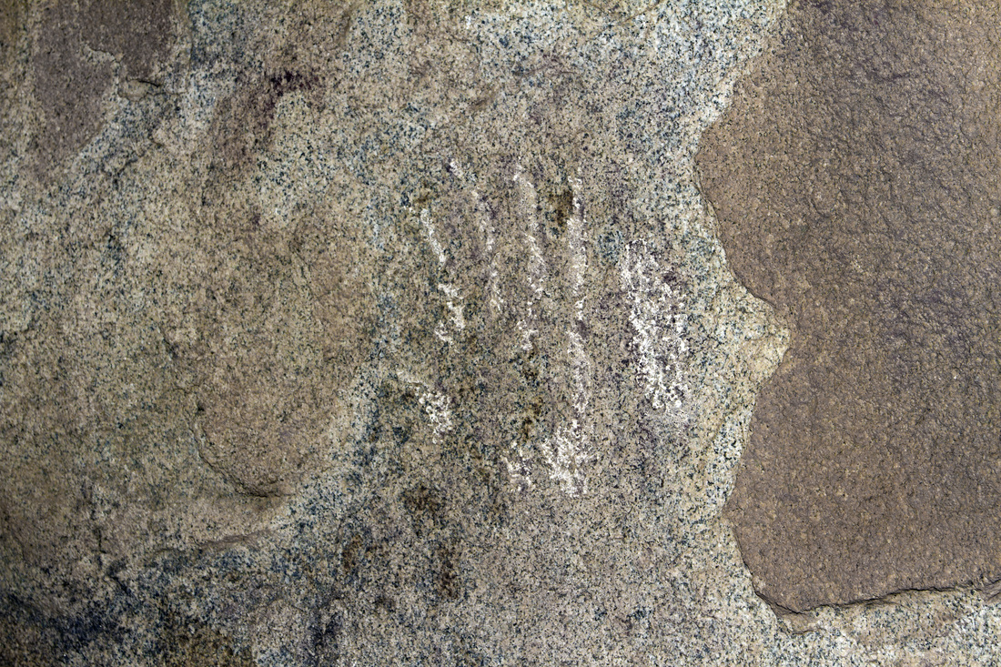
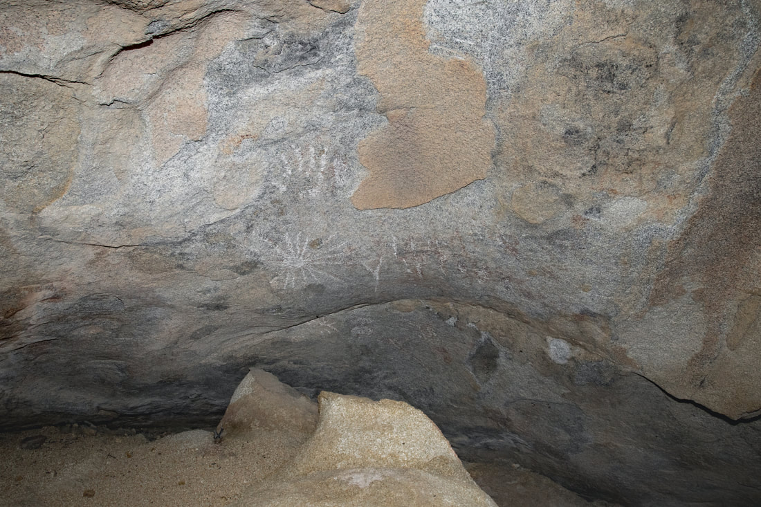
A hand print in white.
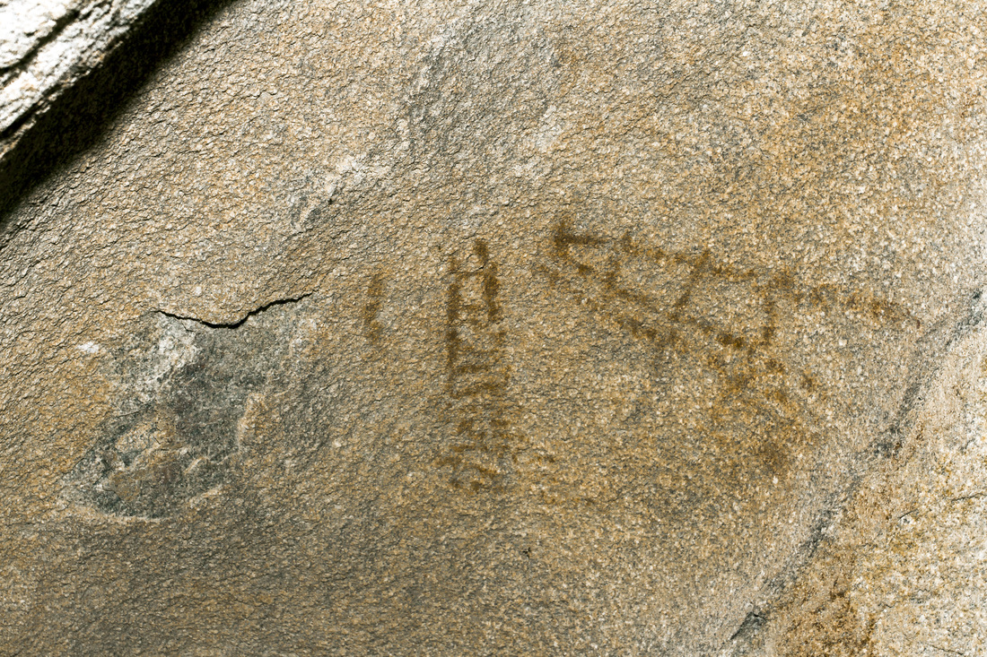
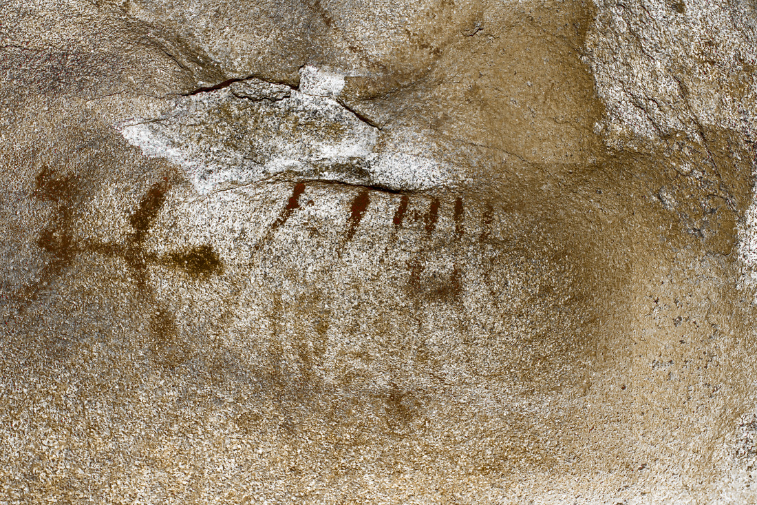
Picture
Ladder
Picture
Picture
Picture
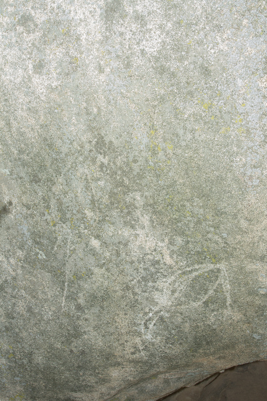
Etched Petroglyphs within the stone
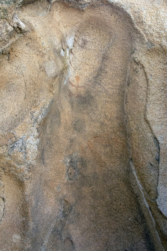
Picture
Pictograph before.
Picture
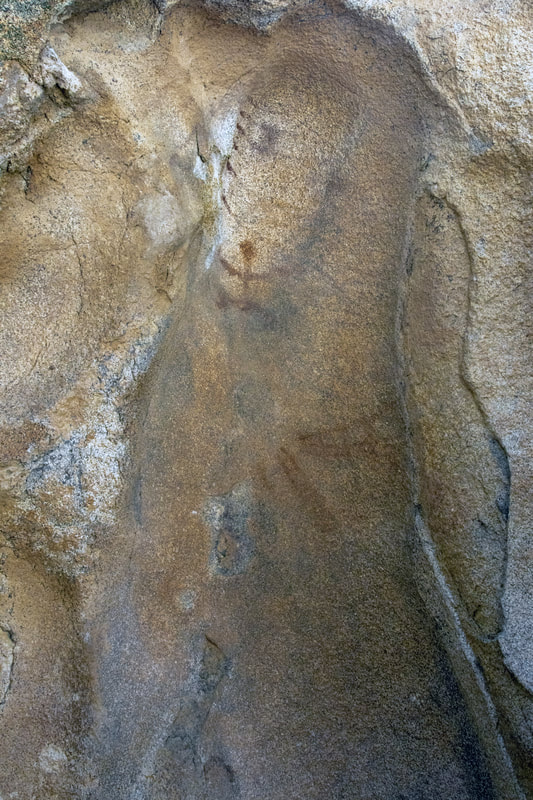
I used Photoshop to augment the pictographs, tring to keep the colors as close as possible to the original.
Picture
Picture
I apologize for not give out directions to most of my trips, trails change and I do not have the time to keep the site always updated. My hikes also span from the easy to the extreme, a lot of places do not even have trails, as well as extreme conditions. Some sites need to be protected as they are fragile and historically sensitive. So if you decide to hike some of these areas, do your research and know your limits, have the proper provisions .Every year many hikers die  from not understanding these Simple Rules. San Diego County and surrounding areas are diverse in climate and terrain. Remember if you do decide to Hike do your research, carry the essentials and do so at your own risk.  An alternative is to join one of the many hiking groups such as meetup or on facebook ,as well as other social sites. Not only is there safety in numbers but a pooling of knowledge. 
  • Exploring San Diego
  • Day Trips
    • Campo >
      • The Campo Stone Store
      • Campo Pioneer Burial Plots
      • Mystery Rock
      • Rail Road Trestle HWY 94
      • Southern Terminus PCT
      • WWII Pow Chapel
      • Incinerator Camp Lockett
    • Cuyamaca Forest >
      • The Airplane Monument
    • Old Hwy 80 >
      • Boulevard >
        • Masonic Hall Ruins
    • Carlsbad >
      • Mount Calavera
    • Descanso >
      • Ellis Wayside Rest
    • Downtown San Diego >
      • The Old San Diego Jail Cells
    • Escondido >
      • Lake Hodges Dam
    • Jacumba >
      • Mica Gem Mine
      • Carrizo Creek Area
      • Goat Canyon Trestle
      • Happy's Place
      • Jacume
      • Round Mountain
      • Table Mountain
      • Union 76 Sign
      • Valley of The Moon and Vicinity >
        • Border Marker 231
        • Cabin Ruins
        • The Carpet Cave
        • Elliott Mine
        • Smugglers Cave
        • The Antenna Ruins
    • Jamul >
      • Jamul Cement Works
      • Mt. McGinty
    • La Jolla >
      • Kayaking La Jolla
      • Photos La Jolla
      • Sunny Jim Cave
    • Julian >
      • The Warlock Mine
    • Mission Trails Regional Park >
      • Flooding Mission Trails
      • Tree Frogs Season
    • Mountain Springs >
      • Devils Canyon
      • Happy's Camps
      • The Sheep Pens
    • Mount Laguna Area >
      • Pine Valley >
        • Secret Canyon Trail
      • Laguna Meadows >
        • The Pioneer Cemetery
      • Garnet Peak
      • The Pioneer Mail Trail
      • The Pump House
    • Point Loma >
      • Battery E Control Station
      • Bennington Memorial
      • Sea Caves Point Loma
    • Solana Beach >
      • Annies Canyon Trail
  • Forgotten Places
    • Ruin Rancho San Diego
    • Abandone Builldings Lake Morena
    • Abandoned Homestead Site
    • Abandone Home Stead 2
    • The Hidden Cave
    • Bankhead Springs Ghost Town
    • The Forgotten Tunnels
    • Buckman's Springs
    • Old Mines Various
    • Pirates Tower
    • Ghost Signs
    • Manhattan AZ Set
    • School Mine
  • Local WaterFalls
    • Mildred Falls
    • Kitchen Creek Falls
    • Orinoco Creek Falls
    • Three Sisters
    • Storm Canyon Waterfall
    • The Devils Jumpoff
    • Cold Stream Falls
    • Cedar Creek
    • Miadenhair Falls
    • Lake Hodges Falls
    • Waterfalls of Oak Canyon
    • Waterfalls of Cottonwood Creek
    • Green Valley Falls
    • Waterfalls of Chariot Canyon
    • Pinto Canyon Falls
  • Rock Art
    • Anza Borrego 2 Rock Art
    • Cave with No Name
    • Initiation Cave
    • The Lizard Man Cave
    • Petroglyph Site
    • Pictographs November 2012
    • Strange Petroglyphs in Imperial County
    • Rock Art Northern San Diego 1
    • Rock Art Site 2
    • Rock Art Site 3
    • Rock Art Various
    • Unknown Rock Art San Diego County
    • Vallecitos Rock Art
    • Milling Sites >
      • Cuayamaca Ovals
  • Beyond
    • Arizona >
      • Yuma >
        • Bridge to Nowhere
        • Castle Dome Ghost Town
        • Yuma Territorial Prison
    • Imperial County >
      • Anza Borrego >
        • Andrade Canyon
        • Carrizo Mountain
        • The Domelands
        • The Slot
        • Morteros Palms to Goat Canyon
        • Sunrise Butte
        • Yuha Basin
        • Mud Caves
        • Rock House Valley
        • Upper Myers Valley
      • Salton Sea >
        • Mud Volanoes
        • The Old Health Spa
        • Salvation Mountain
    • San Gabriel Mountains >
      • The Bridge to Nowhere
  • The Spooky Side
    • Dead Man's Point
    • Mount Pisquah
    • Pioneer Park
    • Witches Tower
    • Haunted Locations >
      • Hangar One Miramar
      • Julian Hotel
      • Queen Mary >
        • First Class Swimming Pool
        • Water Tight Door 13
      • Vallecitos Stage Station
    • Graves >
      • Grave of Kate Morgan
      • Graves Under San Diego Ave
      • Lady in White Grave
      • The Lonely Grave of Amos Buckman
      • The Forgotten Grave of John Helm
      • Whaley Grave
      • Yankee Jim
  • Hollywood F
  • New Page