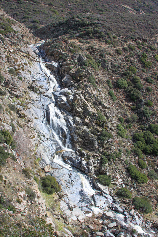
Kitchen Creek Falls
|
|
|
Kitchen Creek, Cleveland National Forest
Beleive That an Adventure Pass is required to park, don't know if they enforce this.
Highly Seasonal not every year.
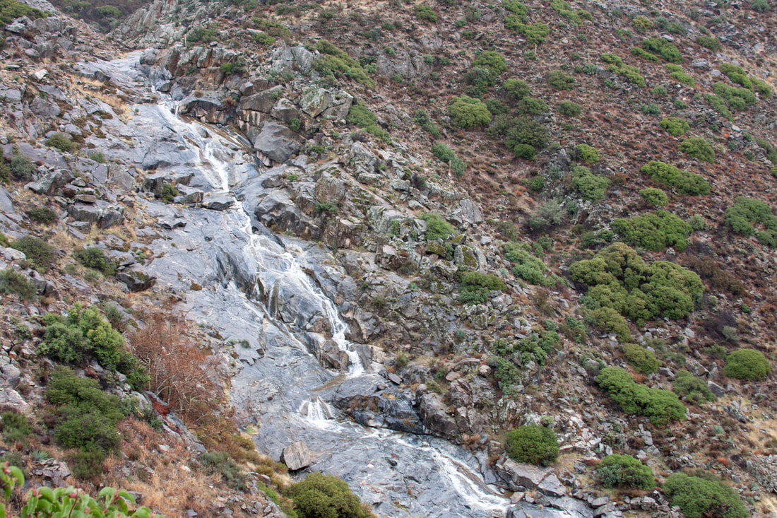
Cascades
Obstructed View.
Off the Pacific Crest Trail, and no marker for the turnoff, need to do your research before going.
To access its elevation gain if accessing from Old Hwy 80 and a rugged trail from The Pacific Crest down to the falls.
Located San Diego County California
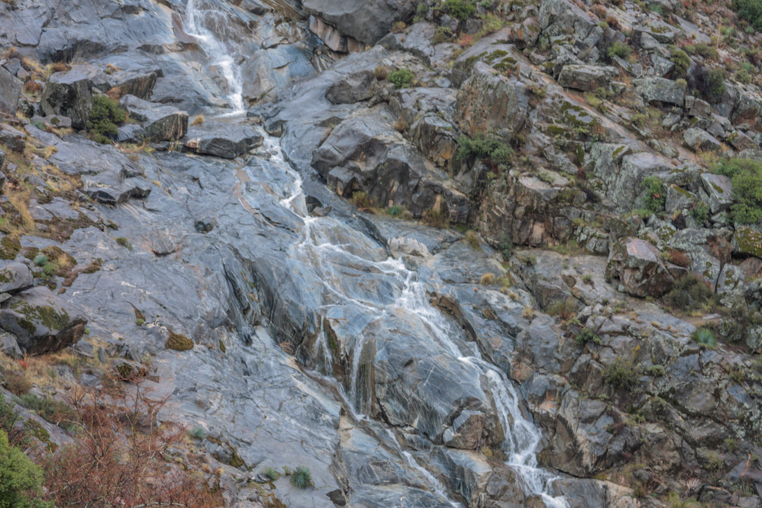
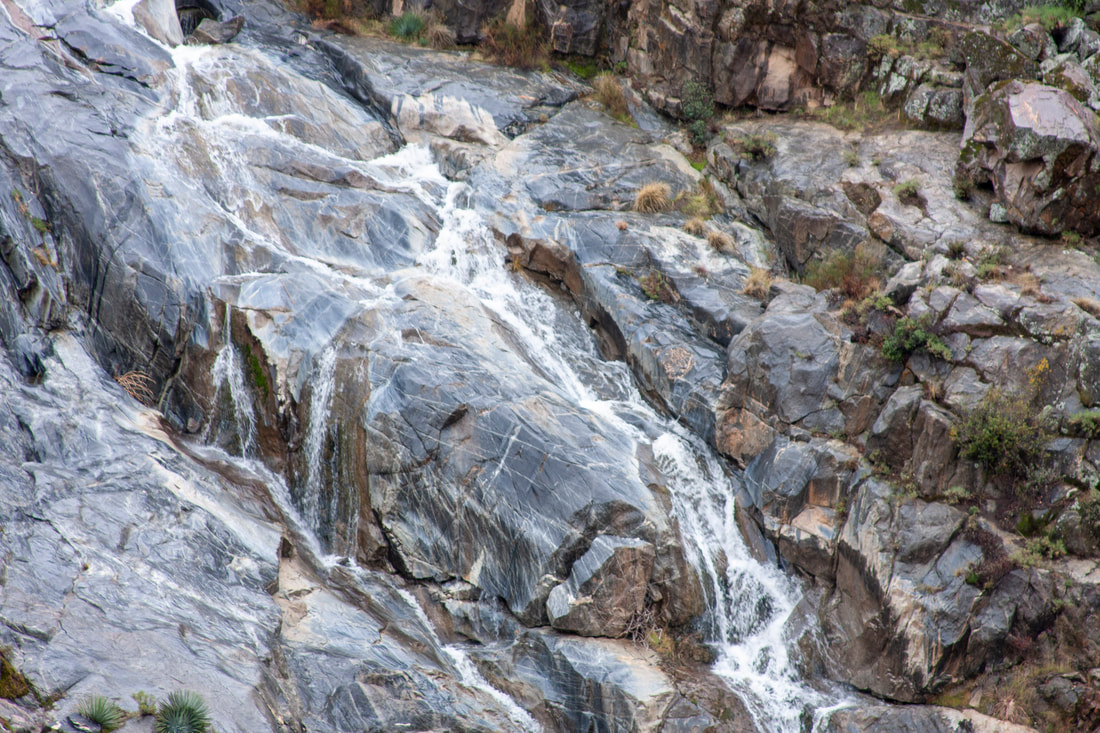
Tuck away in a bend in a canyon on Kitchen Creek , this cascading falls is hard to get a good vantage, of the entire set of falls, located off of The Pacific Crest Trail it can be a bit tricky to locate. The video I took require some bushwhacking to a vantage point to get it. The rocks around the falls can be super slippery so beware.
Remember once againThere is no marker, don't be afraid to ask direction from other people on The PCT, Pacific Crest Trail and do your research.
Height estimate around 150 feet
Kitchen Creek, Cleveland National Forest
Beleive That an Adventure Pass is required to park, don't know if they enforce this.
Highly Seasonal not every year.
Cascades
Obstructed View.
Off the Pacific Crest Trail, and no marker for the turnoff, need to do your research before going.
To access its elevation gain if accessing from Old Hwy 80 and a rugged trail from The Pacific Crest down to the falls.
Located San Diego County California
Tuck away in a bend in a canyon on Kitchen Creek , this cascading falls is hard to get a good vantage, of the entire set of falls, located off of The Pacific Crest Trail it can be a bit tricky to locate. The video I took require some bushwhacking to a vantage point to get it. The rocks around the falls can be super slippery so beware.
Remember once againThere is no marker, don't be afraid to ask direction from other people on The PCT, Pacific Crest Trail and do your research.
Height estimate around 150 feet
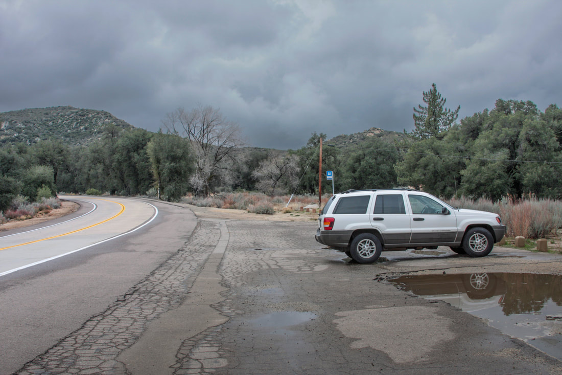
So this photo was with my old Jeep and was taken back in 2009, you can tell this because its parked by itself at the Parking for The PCT on Old Hwy 80. You park here now adays and you'll probably be hard press to find a spot.
Back then I would hike to the falls and have it all to myself.
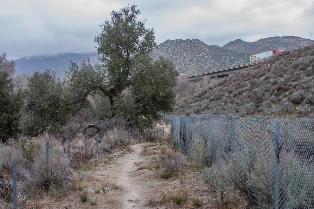
Across the road from The Parking for The PCT is the trail heading under The Bridge on Hwy 8. I hike up to the falls on a rainy day to maximize my chances to find a good flow on the falls, so a lot of my photos will have hazy backgrounds
|
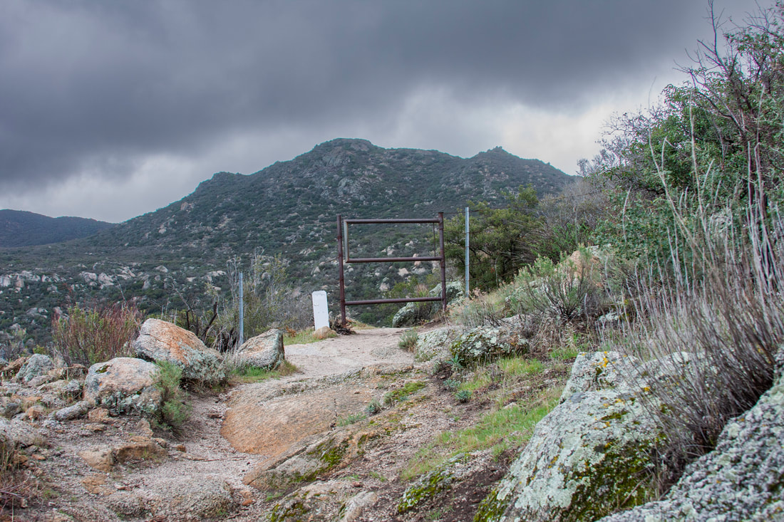
One of two gates on The right of way fence for The Bridge on HWY 8. Keeps wildlife and possibly cattle from accessing the Highway so please close them.
|
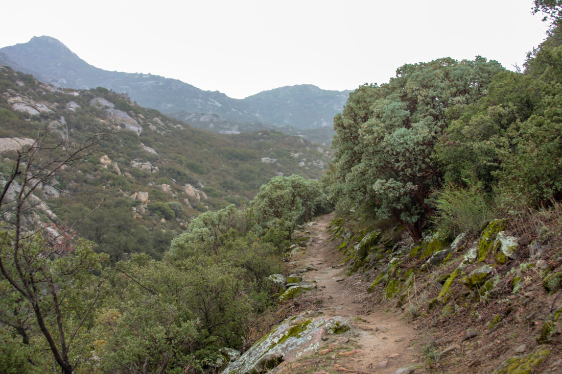
Passing through The Manzanitia Forest. The original people of this area used this plant for a lot of uses, food and even for
toothbrushing. Look at the ground and you will see the flowers falling from the tree, the later fruit is where Manzanita or Little Apple gets its name. The Humming Birds flock to this area for the abundant food and breeding at this time. They buzz by you as you travel the trail.
|
|
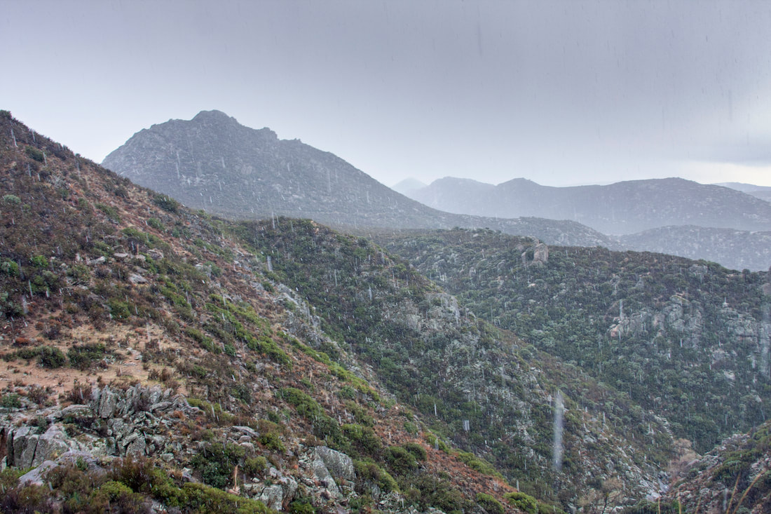
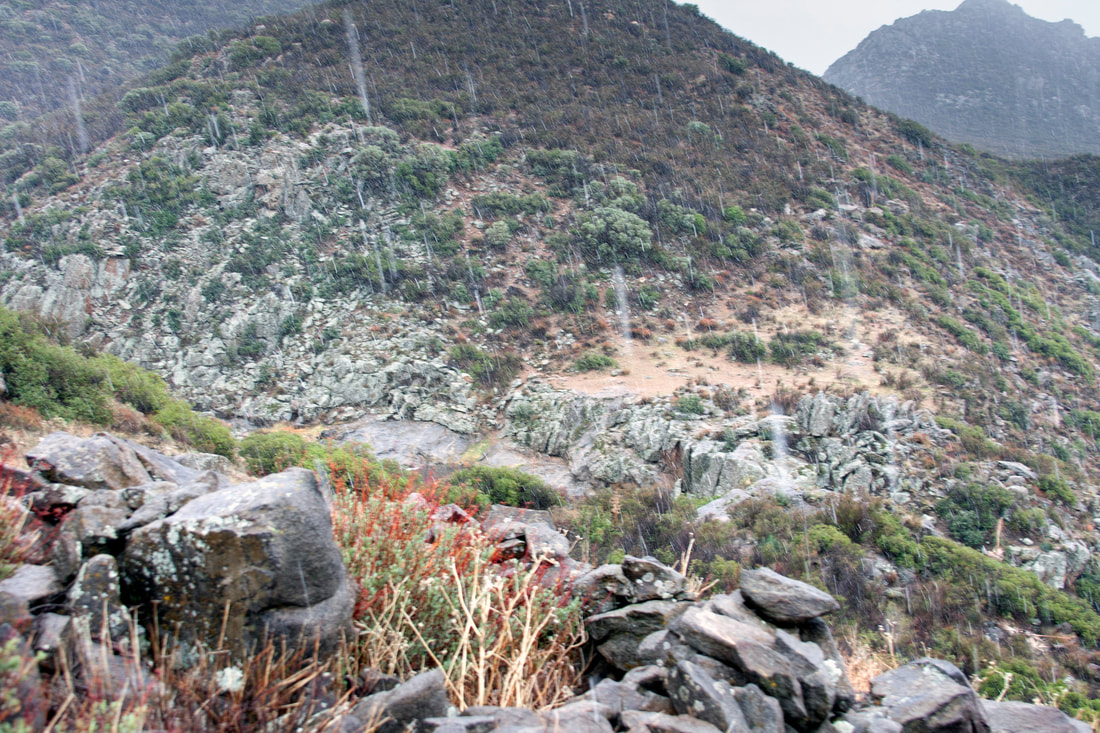
All the way to the falls was intermittant rain and snow. Though the snow melted upon hitting the ground. Though it makes for a gloomy hike. The rocks colors jump out
|
|
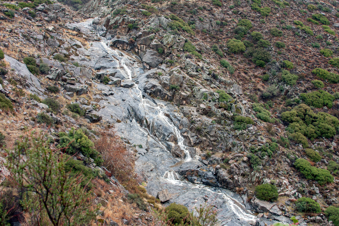
The Falls
|
|
|
|
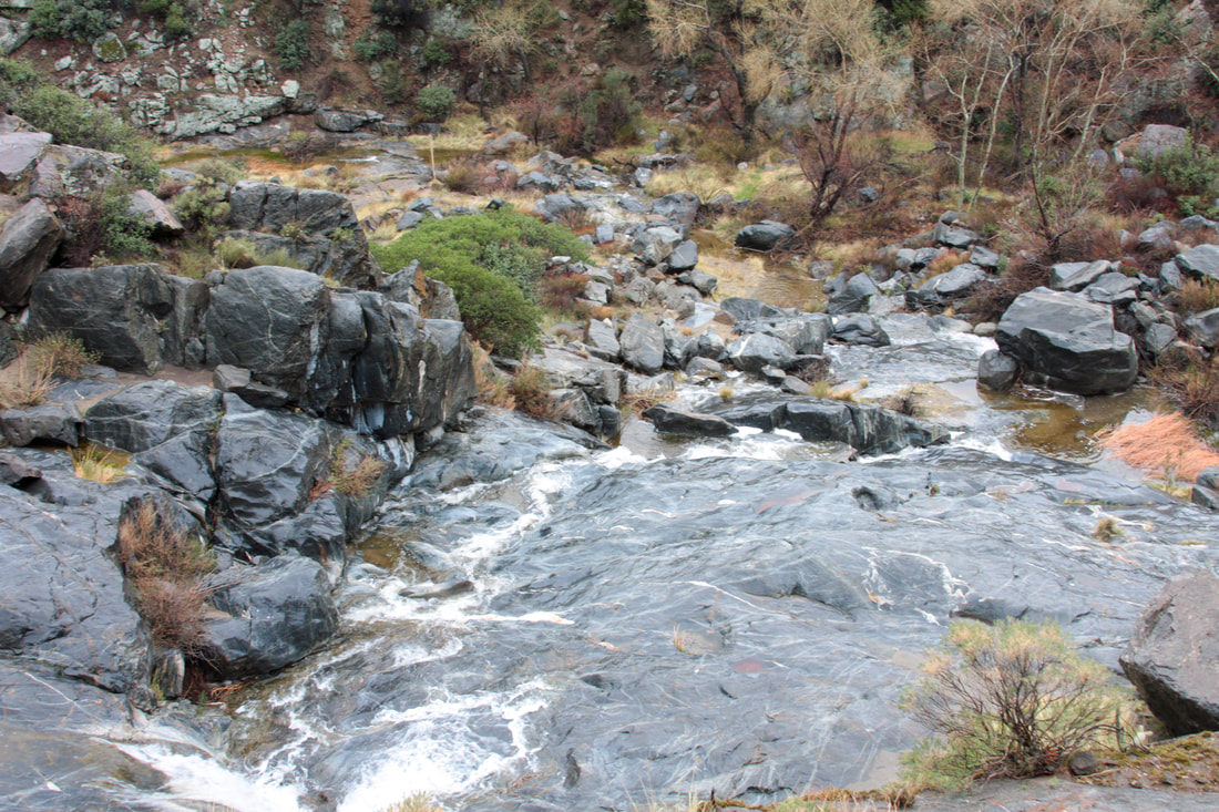
The Bottom
Fall 2010
