EXPLORING SAN DIEGO COUNTY AND BEYOND BY LENS
  • Exploring San Diego
  • Day Trips
    • Campo >
      • The Campo Stone Store
      • Campo Pioneer Burial Plots
      • Mystery Rock
      • Rail Road Trestle HWY 94
      • Southern Terminus PCT
      • WWII Pow Chapel
      • Incinerator Camp Lockett
    • Cuyamaca Forest >
      • The Airplane Monument
    • Old Hwy 80 >
      • Boulevard >
        • Masonic Hall Ruins
    • Carlsbad >
      • Mount Calavera
    • Descanso >
      • Ellis Wayside Rest
    • Downtown San Diego >
      • The Old San Diego Jail Cells
    • Escondido >
      • Lake Hodges Dam
    • Jacumba >
      • Mica Gem Mine
      • Carrizo Creek Area
      • Goat Canyon Trestle
      • Happy's Place
      • Jacume
      • Round Mountain
      • Table Mountain
      • Union 76 Sign
      • Valley of The Moon and Vicinity >
        • Border Marker 231
        • Cabin Ruins
        • The Carpet Cave
        • Elliott Mine
        • Smugglers Cave
        • The Antenna Ruins
    • Jamul >
      • Jamul Cement Works
      • Mt. McGinty
    • La Jolla >
      • Kayaking La Jolla
      • Photos La Jolla
      • Sunny Jim Cave
    • Julian >
      • The Warlock Mine
    • Mission Trails Regional Park >
      • Flooding Mission Trails
      • Tree Frogs Season
    • Mountain Springs >
      • Devils Canyon
      • Happy's Camps
      • The Sheep Pens
    • Mount Laguna Area >
      • Pine Valley >
        • Secret Canyon Trail
      • Laguna Meadows >
        • The Pioneer Cemetery
      • Garnet Peak
      • The Pioneer Mail Trail
      • The Pump House
    • Point Loma >
      • Battery E Control Station
      • Bennington Memorial
      • Sea Caves Point Loma
    • Solana Beach >
      • Annies Canyon Trail
  • Forgotten Places
    • Ruin Rancho San Diego
    • Abandone Builldings Lake Morena
    • Abandoned Homestead Site
    • Abandone Home Stead 2
    • The Hidden Cave
    • Bankhead Springs Ghost Town
    • The Forgotten Tunnels
    • Buckman's Springs
    • Old Mines Various
    • Pirates Tower
    • Ghost Signs
    • Manhattan AZ Set
    • School Mine
  • Local WaterFalls
    • Mildred Falls
    • Kitchen Creek Falls
    • Orinoco Creek Falls
    • Three Sisters
    • Storm Canyon Waterfall
    • The Devils Jumpoff
    • Cold Stream Falls
    • Cedar Creek
    • Miadenhair Falls
    • Lake Hodges Falls
    • Waterfalls of Oak Canyon
    • Waterfalls of Cottonwood Creek
    • Green Valley Falls
    • Waterfalls of Chariot Canyon
    • Pinto Canyon Falls
  • Rock Art
    • Anza Borrego 2 Rock Art
    • Cave with No Name
    • Initiation Cave
    • The Lizard Man Cave
    • Petroglyph Site
    • Pictographs November 2012
    • Strange Petroglyphs in Imperial County
    • Rock Art Northern San Diego 1
    • Rock Art Site 2
    • Rock Art Site 3
    • Rock Art Various
    • Unknown Rock Art San Diego County
    • Vallecitos Rock Art
    • Milling Sites >
      • Cuayamaca Ovals
  • Beyond
    • Arizona >
      • Yuma >
        • Bridge to Nowhere
        • Castle Dome Ghost Town
        • Yuma Territorial Prison
    • Imperial County >
      • Anza Borrego >
        • Andrade Canyon
        • Carrizo Mountain
        • The Domelands
        • The Slot
        • Morteros Palms to Goat Canyon
        • Sunrise Butte
        • Yuha Basin
        • Mud Caves
        • Rock House Valley
        • Upper Myers Valley
      • Salton Sea >
        • Mud Volanoes
        • The Old Health Spa
        • Salvation Mountain
    • San Gabriel Mountains >
      • The Bridge to Nowhere
  • The Spooky Side
    • Dead Man's Point
    • Mount Pisquah
    • Pioneer Park
    • Witches Tower
    • Haunted Locations >
      • Hangar One Miramar
      • Julian Hotel
      • Queen Mary >
        • First Class Swimming Pool
        • Water Tight Door 13
      • Vallecitos Stage Station
    • Graves >
      • Grave of Kate Morgan
      • Graves Under San Diego Ave
      • Lady in White Grave
      • The Lonely Grave of Amos Buckman
      • The Forgotten Grave of John Helm
      • Whaley Grave
      • Yankee Jim
  • Hollywood F
  • New Page

The Ellis Wayside Rest

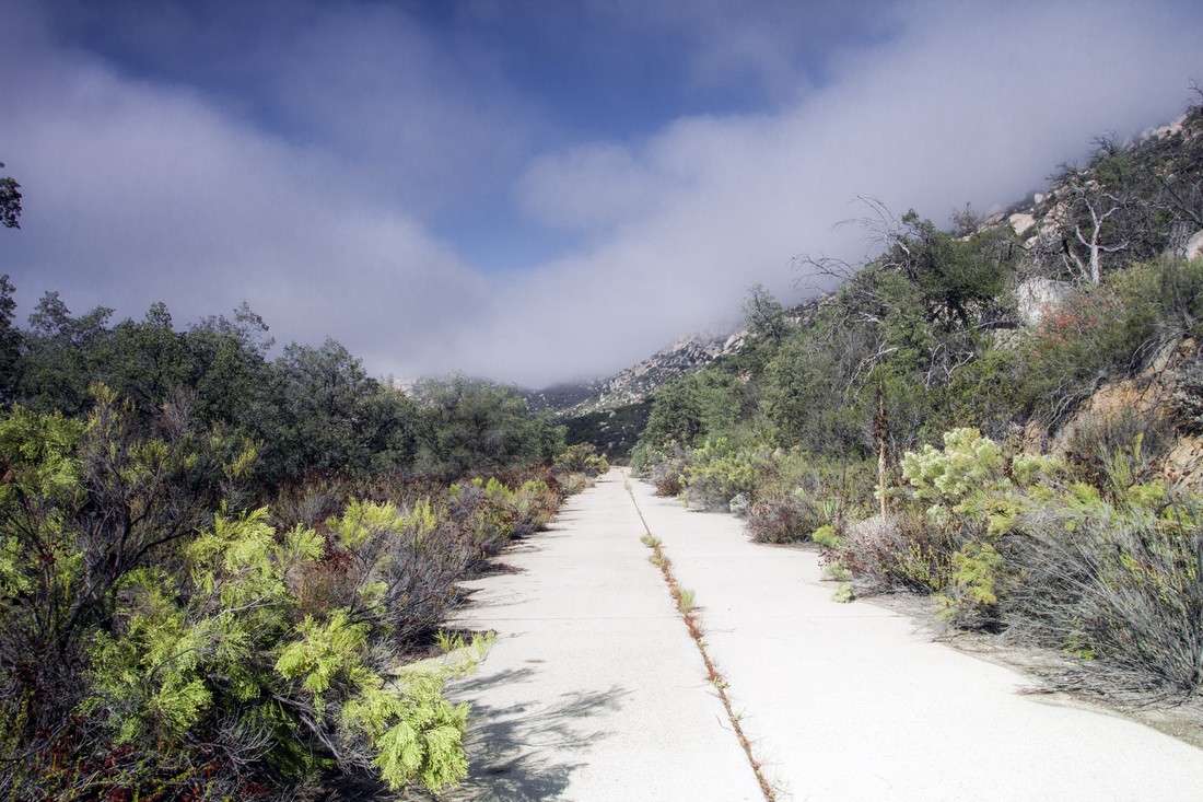
Located near Descanso, there is a cutoff section of the Old Highway 80. The road is still visible though nature is slowly reclaiming it, in sections of it landslides and vegetation are covering it. The road is still in good shape, but as one progresses down the road it slowly becomes buried due to erosion of the surrounding land.

​A ways down you come to a pile of stones, There is some noticeable graffiti and what appears to be a man made depression within one of the rocks. You have stumbled upon what remains of the Ellis Wayside Rest. This was a stop for the road weary traveler, since the 1930's one could stop and rest here. The man made depression, if you look closely, has a small hole drilled into it. This was were the depression was fed by springs up the hill, The springs were discovered by Charles Ellis about the turn of the century. One could get water to drink or to fill one Radiator.
​
Picture
This old 1930's section of Hwy 80 is located at the end of Wildwood Glen Lane, there is a locked gate and a parking spot .
Charles Ellis is the man The Ellis Wayside Rest was name for. He settled in the area in the 1860's and was a station master at Coyote Wells.
Picture
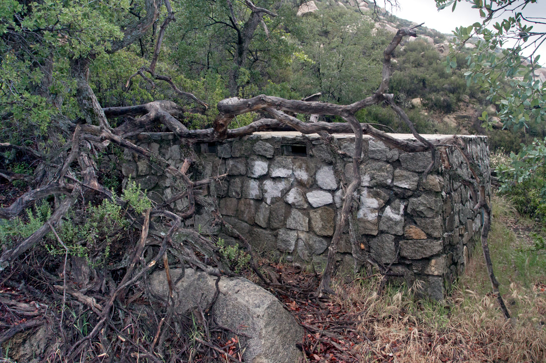
The Ellis Wayside Rest is located down the old Hwy 80 section pass the gate. This is a water cistern tucked up into the rocks, it fed a water catchment down below in a large boulder.

Picture
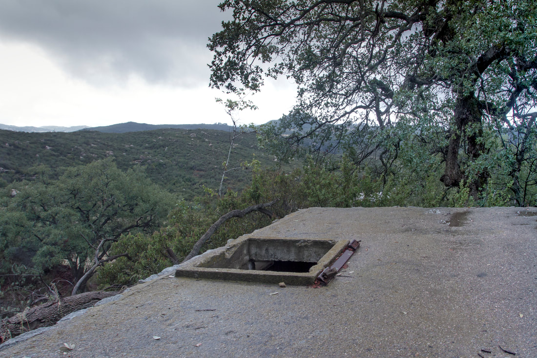
Hatch that leads down into the cistern.
Picture
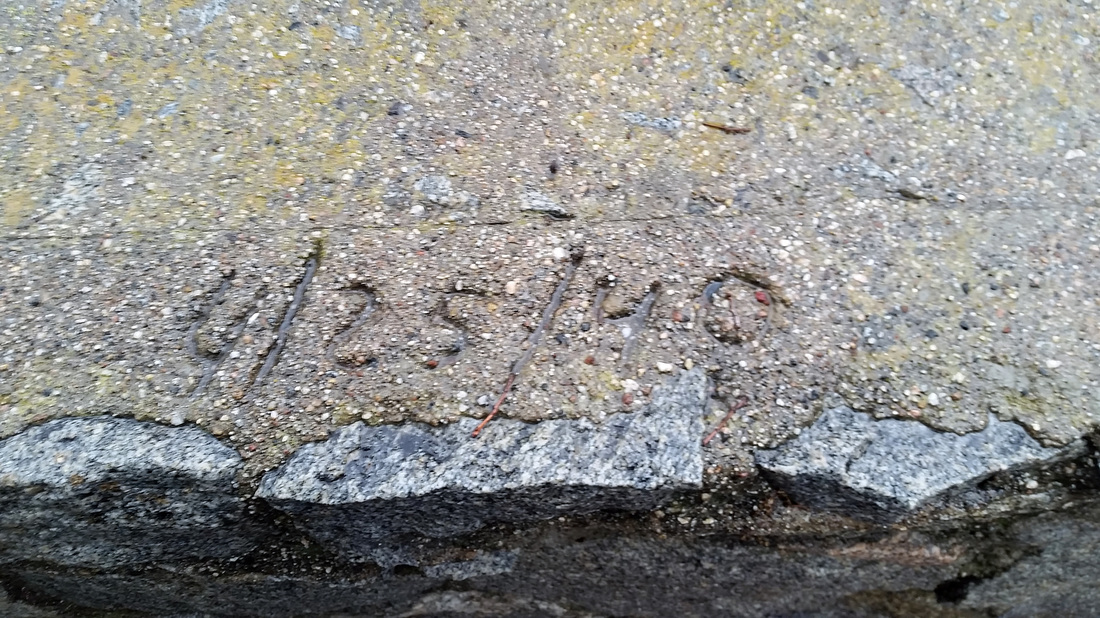
Inscription on top of the water cistern seem to say 4/25/48 possibly 40
Picture
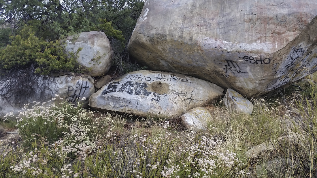
The water feed for the small depression, is a cistern behind the boulder. Like a lot of areas we visit the ever present graffiti.
Picture
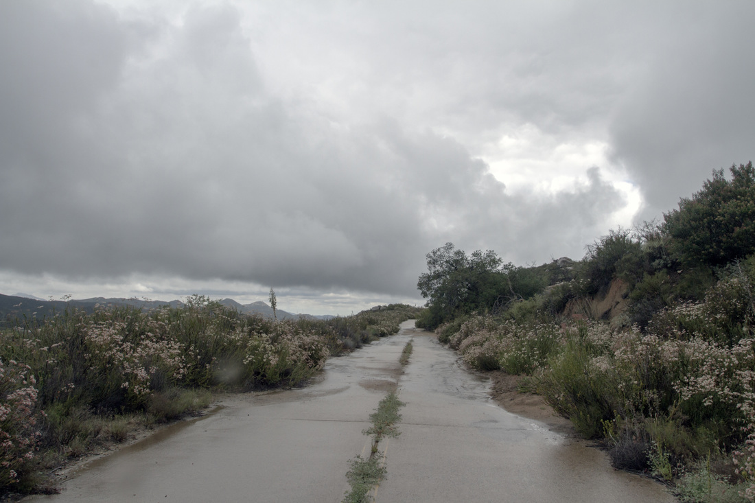
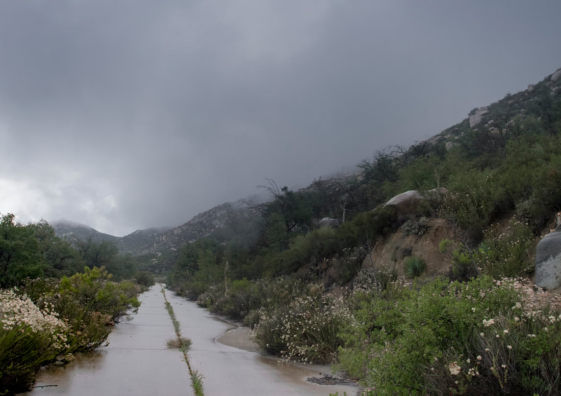
The first day I went there was a storm, Here the road is over run with the local vegetation and soil that has eroded from the hillside.
Picture
Picture
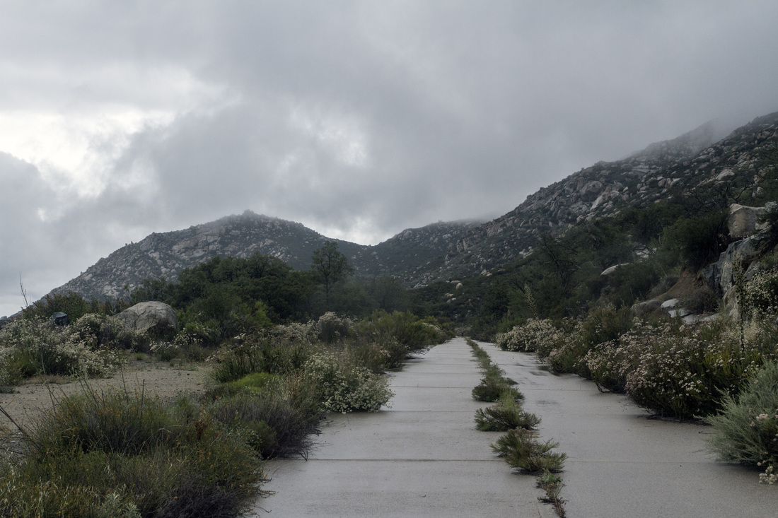
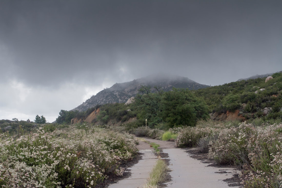
The Storm is blowing in
Picture
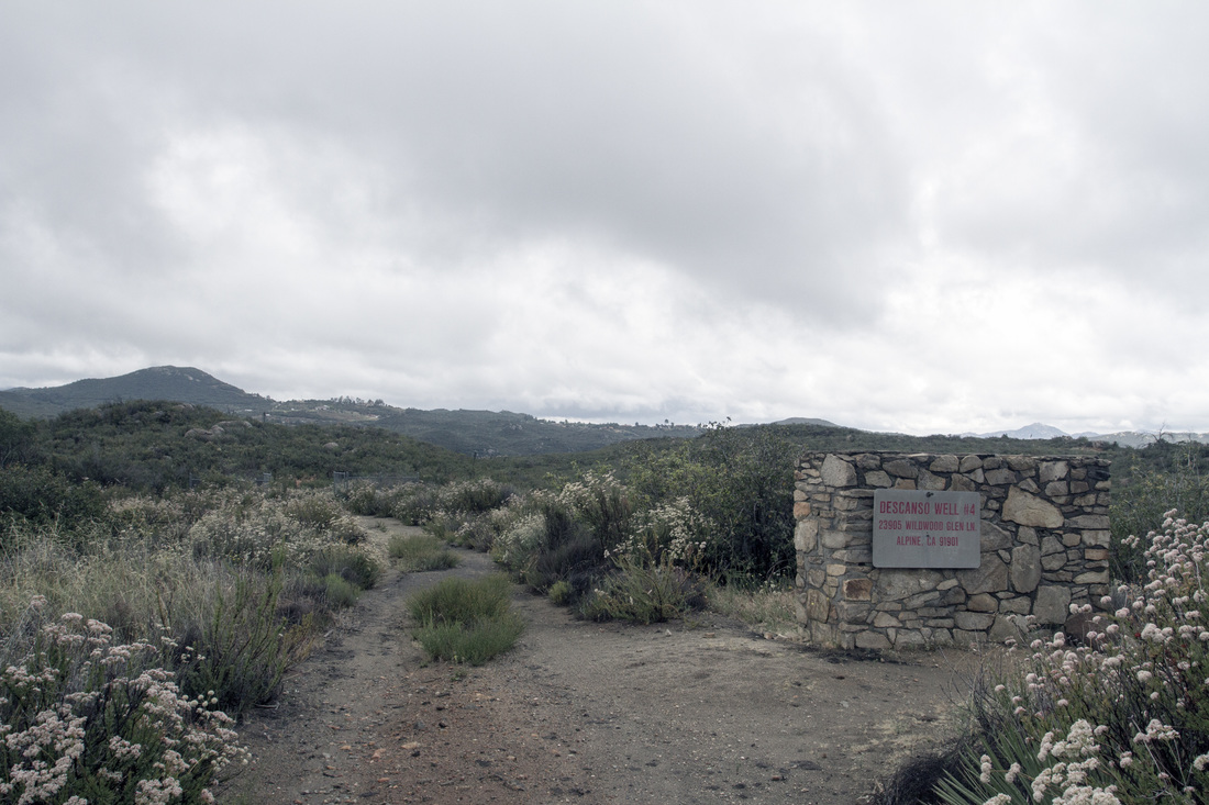
Descanso Well #4, a road leading down the hill to one of the areas watersources.
Picture
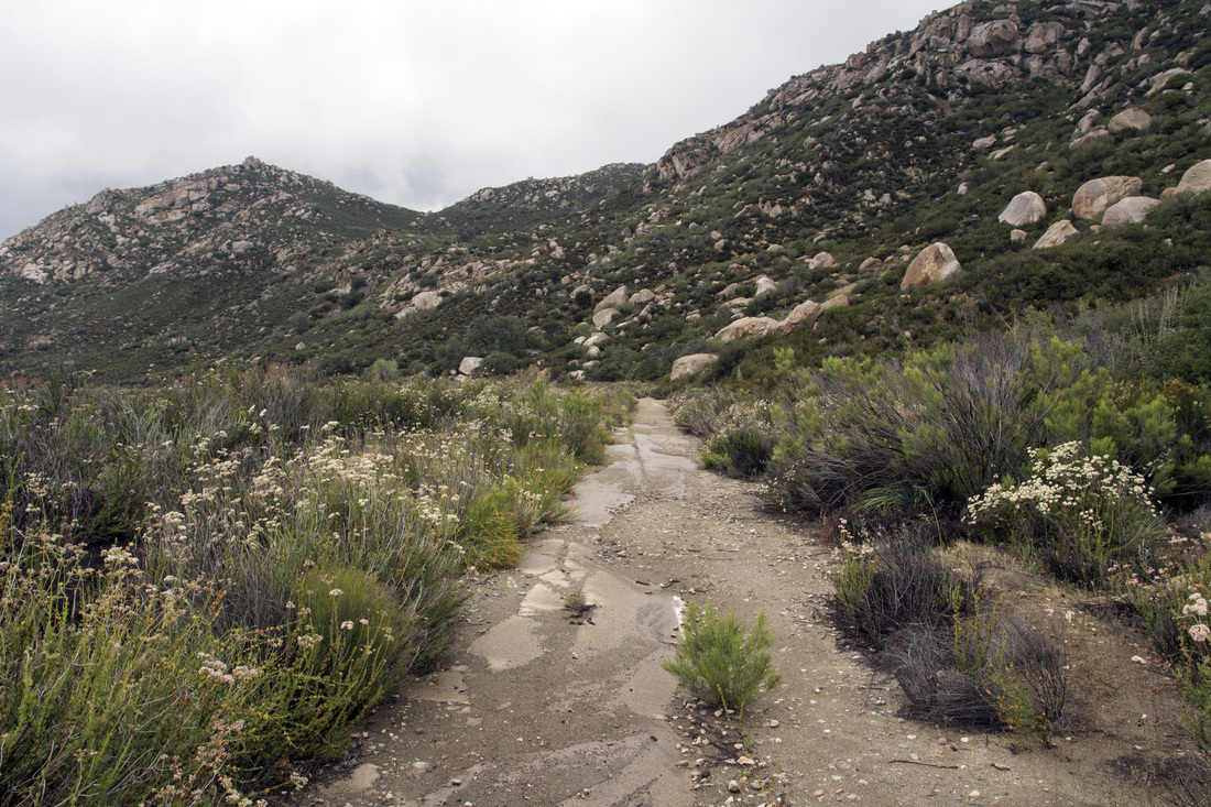
Here's a down hill section being undermined and covered by natural erosion, as you head westward on this section the road tends to get more covered and finally disappears beneath the soil.
Picture
I apologize for not give out directions to most of my trips, trails change and I do not have the time to keep the site always updated. My hikes also span from the easy to the extreme, a lot of places do not even have trails, as well as extreme conditions. Some sites need to be protected as they are fragile and historically sensitive. So if you decide to hike some of these areas, do your research and know your limits, have the proper provisions .Every year many hikers die  from not understanding these Simple Rules. San Diego County and surrounding areas are diverse in climate and terrain. Remember if you do decide to Hike do your research, carry the essentials and do so at your own risk.  An alternative is to join one of the many hiking groups such as meetup or on facebook ,as well as other social sites. Not only is there safety in numbers but a pooling of knowledge. 
  • Exploring San Diego
  • Day Trips
    • Campo >
      • The Campo Stone Store
      • Campo Pioneer Burial Plots
      • Mystery Rock
      • Rail Road Trestle HWY 94
      • Southern Terminus PCT
      • WWII Pow Chapel
      • Incinerator Camp Lockett
    • Cuyamaca Forest >
      • The Airplane Monument
    • Old Hwy 80 >
      • Boulevard >
        • Masonic Hall Ruins
    • Carlsbad >
      • Mount Calavera
    • Descanso >
      • Ellis Wayside Rest
    • Downtown San Diego >
      • The Old San Diego Jail Cells
    • Escondido >
      • Lake Hodges Dam
    • Jacumba >
      • Mica Gem Mine
      • Carrizo Creek Area
      • Goat Canyon Trestle
      • Happy's Place
      • Jacume
      • Round Mountain
      • Table Mountain
      • Union 76 Sign
      • Valley of The Moon and Vicinity >
        • Border Marker 231
        • Cabin Ruins
        • The Carpet Cave
        • Elliott Mine
        • Smugglers Cave
        • The Antenna Ruins
    • Jamul >
      • Jamul Cement Works
      • Mt. McGinty
    • La Jolla >
      • Kayaking La Jolla
      • Photos La Jolla
      • Sunny Jim Cave
    • Julian >
      • The Warlock Mine
    • Mission Trails Regional Park >
      • Flooding Mission Trails
      • Tree Frogs Season
    • Mountain Springs >
      • Devils Canyon
      • Happy's Camps
      • The Sheep Pens
    • Mount Laguna Area >
      • Pine Valley >
        • Secret Canyon Trail
      • Laguna Meadows >
        • The Pioneer Cemetery
      • Garnet Peak
      • The Pioneer Mail Trail
      • The Pump House
    • Point Loma >
      • Battery E Control Station
      • Bennington Memorial
      • Sea Caves Point Loma
    • Solana Beach >
      • Annies Canyon Trail
  • Forgotten Places
    • Ruin Rancho San Diego
    • Abandone Builldings Lake Morena
    • Abandoned Homestead Site
    • Abandone Home Stead 2
    • The Hidden Cave
    • Bankhead Springs Ghost Town
    • The Forgotten Tunnels
    • Buckman's Springs
    • Old Mines Various
    • Pirates Tower
    • Ghost Signs
    • Manhattan AZ Set
    • School Mine
  • Local WaterFalls
    • Mildred Falls
    • Kitchen Creek Falls
    • Orinoco Creek Falls
    • Three Sisters
    • Storm Canyon Waterfall
    • The Devils Jumpoff
    • Cold Stream Falls
    • Cedar Creek
    • Miadenhair Falls
    • Lake Hodges Falls
    • Waterfalls of Oak Canyon
    • Waterfalls of Cottonwood Creek
    • Green Valley Falls
    • Waterfalls of Chariot Canyon
    • Pinto Canyon Falls
  • Rock Art
    • Anza Borrego 2 Rock Art
    • Cave with No Name
    • Initiation Cave
    • The Lizard Man Cave
    • Petroglyph Site
    • Pictographs November 2012
    • Strange Petroglyphs in Imperial County
    • Rock Art Northern San Diego 1
    • Rock Art Site 2
    • Rock Art Site 3
    • Rock Art Various
    • Unknown Rock Art San Diego County
    • Vallecitos Rock Art
    • Milling Sites >
      • Cuayamaca Ovals
  • Beyond
    • Arizona >
      • Yuma >
        • Bridge to Nowhere
        • Castle Dome Ghost Town
        • Yuma Territorial Prison
    • Imperial County >
      • Anza Borrego >
        • Andrade Canyon
        • Carrizo Mountain
        • The Domelands
        • The Slot
        • Morteros Palms to Goat Canyon
        • Sunrise Butte
        • Yuha Basin
        • Mud Caves
        • Rock House Valley
        • Upper Myers Valley
      • Salton Sea >
        • Mud Volanoes
        • The Old Health Spa
        • Salvation Mountain
    • San Gabriel Mountains >
      • The Bridge to Nowhere
  • The Spooky Side
    • Dead Man's Point
    • Mount Pisquah
    • Pioneer Park
    • Witches Tower
    • Haunted Locations >
      • Hangar One Miramar
      • Julian Hotel
      • Queen Mary >
        • First Class Swimming Pool
        • Water Tight Door 13
      • Vallecitos Stage Station
    • Graves >
      • Grave of Kate Morgan
      • Graves Under San Diego Ave
      • Lady in White Grave
      • The Lonely Grave of Amos Buckman
      • The Forgotten Grave of John Helm
      • Whaley Grave
      • Yankee Jim
  • Hollywood F
  • New Page